Thị Trấn Na Hang geodata
Thị Trấn Na Hang (Tuyên Quang) is a seat of a second-order administrative division; located in Vietnam in Asia/Ho_Chi_Minh (GMT+7) time zone. In our database, there are 94 cities with bigger population. Compared to other cities in Vietnam, 94% of cities are located further ↓South; 80.8% of cities are located further →East and 71.9% of cities have lower elevation than Thị Trấn Na Hang. Note1


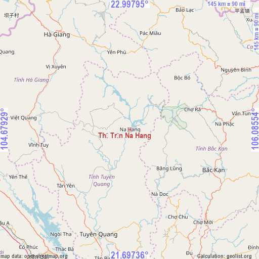
Thị Trấn Na Hang GPS coordinates[2]
22° 20' 57.012" North, 105° 22' 56.676" East
| Map corner | latitude | longitude |
|---|---|---|
| Upper-left | 22.99795°, | 104.67929° |
| Center: | 22.34917°, | 105.38241° |
| Lower-right: | 21.69736°, | 106.08554° |
| Map W x H: | 144.6×144.6 km | = 89.9×89.9mi |
| max Lat: | 23.27841° ⇑6% North |
| Thị Trấn Na Hang: | 22.34917° |
| min Lat: | ⇓94% South 8.65724° |
| min Long | Thị Trấn Na | max Long |
| 102.4579° | 105.38241° | 112.72541° |
| W 19.2%⇐ | ⇒80.8% E |
Elevation
Elevation of Thị Trấn Na Hang is 64 m = 210 ft, and this is 65.5 m = 215 ft below average elevation for this country.
| Max E: |
1592 m = 5223 ft | 28.1% |
| Avg. | 129.5 m = 425 ft | |
| Thị Trấn Na Hang | 64 m = 210 ft | |
Min E: |
-1 m = -3 ft | 71.9% |
See also: Vietnam elevation on elevation.city.
Geographical zone
Thị Trấn Na Hang is located in North Torrid zone (between Equator and Tropic of Cancer). Distance of this Northern Tropic circle is 120.9 km =75.1 mi to North.| Distance of | km | miles | from Thị Trấn Na Hang |
|---|---|---|---|
| North Pole | 7522.1 | 4674 | to North |
| Arctic Circle | 4916.2 | 3054.8 | to North |
| Tropic Cancer | 120.9 | 75.1 | to North |
| Equator | 2485 | 1544.1 | to South |


Nearby cities:
15 places around Thị Trấn Na Hang: (largest is in red/bold)
• Bắc Kạn
51.7 km =32.1 mi,  115°
115°
• Bằng Lũng
30.6 km =19 mi,  134°
134°
• Bộc Bố
41.3 km =25.7 mi,  45°
45°
• Chợ Chu
56 km =34.8 mi,  151°
151°
• Huyện Chiêm Hóa
25.4 km =15.8 mi,  206°
206°
• Phủ Thông
51.8 km =32.2 mi,  99°
99°
• Pác Miầu
54.6 km =33.9 mi,  12°
12°
• Thị Trấn Tân Yên
47.7 km =29.6 mi,  228°
228°
• Thị Trấn Việt Lâm
53.1 km =33 mi,  305°
305°
• Thị Trấn Việt Quang
59.6 km =37 mi,  277°
277°
• Thị Trấn Vĩnh Lộc
25.5 km =15.8 mi, 206°
• Thị Trấn Vĩnh Tuy
51.2 km =31.8 mi,  260°
260°
• Thị Trấn Vị Xuyên
54.3 km =33.7 mi, 310°
• Tân Việt
57.8 km =35.9 mi, 7°
• Yên Phú
42.6 km =26.5 mi,  358°
358°
Sources, notices
• [Note1] Compared only with cities in Vietnam existing in our database
• [Src1] Map data: © OpenStreetMap contributors (CC-BY-SA)
• [Src2] Other city data from geonames.org with taken over terms of usage.
• [Src3] Geographical zone / Annual Mean Temperature by Robert A. Rohde @ Wikipedia
