Huyện Chiêm Hóa geodata
Huyện Chiêm Hóa (Tuyên Quang) is a seat of a second-order administrative division; located in Vietnam in Asia/Ho_Chi_Minh (GMT+7) time zone. In our database, there are 94 cities with bigger population. Compared to other cities in Vietnam, 91.7% of cities are located further ↓South; 83.7% of cities are located further →East and 69.7% of cities have lower elevation than Huyện Chiêm Hóa. Note1


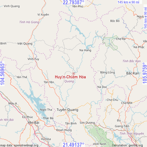
Huyện Chiêm Hóa GPS coordinates[2]
22° 8' 38.868" North, 105° 16' 21.972" East
| Map corner | latitude | longitude |
|---|---|---|
| Upper-left | 22.79387°, | 104.56965° |
| Center: | 22.14413°, | 105.27277° |
| Lower-right: | 21.49137°, | 105.9759° |
| Map W x H: | 144.8×144.8 km | = 90×90mi |
| max Lat: | 23.27841° ⇑8.3% North |
| Huyện Chiêm Hóa: | 22.14413° |
| min Lat: | ⇓91.7% South 8.65724° |
| min Long | Huyện Chiêm | max Long |
| 102.4579° | 105.27277° | 112.72541° |
| W 16.3%⇐ | ⇒83.7% E |
Elevation
Elevation of Huyện Chiêm Hóa is 55 m = 180 ft, and this is 74.5 m = 244 ft below average elevation for this country.
| Max E: |
1592 m = 5223 ft | 30.3% |
| Avg. | 129.5 m = 425 ft | |
| Huyện Chiêm Hóa | 55 m = 180 ft | |
Min E: |
-1 m = -3 ft | 69.7% |
See also: Vietnam elevation on elevation.city.
Geographical zone
Huyện Chiêm Hóa is located in North Torrid zone (between Equator and Tropic of Cancer). Distance of this Northern Tropic circle is 143.7 km =89.3 mi to North.| Distance of | km | miles | from Huyện Chiêm Hóa |
|---|---|---|---|
| North Pole | 7544.9 | 4688.2 | to North |
| Arctic Circle | 4939 | 3069 | to North |
| Tropic Cancer | 143.7 | 89.3 | to North |
| Equator | 2462.2 | 1529.9 | to South |


Nearby cities:
15 places around Huyện Chiêm Hóa: (largest is in red/bold)
• Bắc Kạn
57.9 km =36 mi,  89°
89°
• Bằng Lũng
33.3 km =20.7 mi, 87°
• Chợ Chu
46.3 km =28.8 mi,  124°
124°
• Chợ Mới
59.1 km =36.7 mi, 119°
• Sơn Dương
51.4 km =31.9 mi,  165°
165°
• Thị Trấn Na Hang
25.4 km =15.8 mi,  26°
26°
• Thị Trấn Tân Yên
26.1 km =16.2 mi,  250°
250°
• Thị Trấn Việt Lâm
62.4 km =38.8 mi,  328°
328°
• Thị Trấn Việt Quang
56.6 km =35.2 mi,  302°
302°
• Thị Trấn Vĩnh Lộc
0.1 km =0.1 mi,  236°
236°
• Thị Trấn Vĩnh Tuy
41.9 km =26 mi,  290°
290°
• Thị Trấn Yên Thế
52.2 km =32.4 mi,  265°
265°
• Tuyên Quang
36.2 km =22.5 mi,  189°
189°
• Yên Bái
59.9 km =37.2 mi,  218°
218°
• Đoan Hùng
58.7 km =36.5 mi, 188°
Sources, notices
• [Note1] Compared only with cities in Vietnam existing in our database
• [Src1] Map data: © OpenStreetMap contributors (CC-BY-SA)
• [Src2] Other city data from geonames.org with taken over terms of usage.
• [Src3] Geographical zone / Annual Mean Temperature by Robert A. Rohde @ Wikipedia
