Phủ Thông geodata
Phủ Thông (Bắc Kạn) is a seat of a second-order administrative division; located in Vietnam in Asia/Ho_Chi_Minh (GMT+7) time zone. In our database, there are 94 cities with bigger population. Compared to other cities in Vietnam, 92.8% of cities are located further ↓South; 59.7% of cities are located further →East and 80.9% of cities have lower elevation than Phủ Thông. Note1


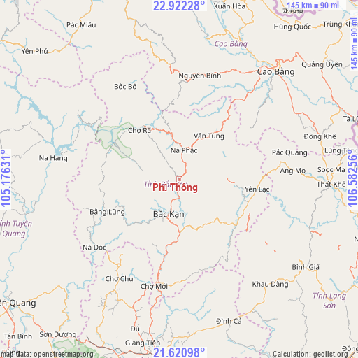
Phủ Thông GPS coordinates[2]
22° 16' 23.304" North, 105° 52' 45.948" East
| Map corner | latitude | longitude |
|---|---|---|
| Upper-left | 22.92228°, | 105.17631° |
| Center: | 22.27314°, | 105.87943° |
| Lower-right: | 21.62098°, | 106.58256° |
| Map W x H: | 144.7×144.7 km | = 89.9×89.9mi |
| max Lat: | 23.27841° ⇑7.2% North |
| Phủ Thông: | 22.27314° |
| min Lat: | ⇓92.8% South 8.65724° |
| min Long | Phủ Thông | max Long |
| 102.4579° | 105.87943° | 112.72541° |
| W 40.3%⇐ | ⇒59.7% E |
Elevation
Elevation of Phủ Thông is 186 m = 610 ft, and this is 56.5 m = 185 ft above average elevation for this country.
| Max E: |
1592 m = 5223 ft | 19.1% |
| Phủ Thông | 186 m 610 ft | |
| Avg. | 129.5 m = 425 ft | |
Min E: |
-1 m = -3 ft | 80.9% |
See also: Vietnam elevation on elevation.city.
Geographical zone
Phủ Thông is located in North Torrid zone (between Equator and Tropic of Cancer). Distance of this Northern Tropic circle is 129.4 km =80.4 mi to North.| Distance of | km | miles | from Phủ Thông |
|---|---|---|---|
| North Pole | 7530.5 | 4679.2 | to North |
| Arctic Circle | 4924.6 | 3060 | to North |
| Tropic Cancer | 129.4 | 80.4 | to North |
| Equator | 2476.5 | 1538.8 | to South |


Nearby cities:
15 places around Phủ Thông: (largest is in red/bold)
• Bình Gia
60.8 km =37.8 mi,  124°
124°
• Bắc Kạn
14.8 km =9.2 mi,  198°
198°
• Bằng Lũng
31.9 km =19.8 mi,  246°
246°
• Bộc Bố
43.5 km =27 mi,  329°
329°
• Cao Bằng
58.5 km =36.4 mi,  41°
41°
• Chợ Chu
47.5 km =29.5 mi,  210°
210°
• Chợ Mới
44.7 km =27.8 mi,  194°
194°
• Thị Trấn Na Hang
51.8 km =32.2 mi,  279°
279°
• Thị Trấn Nguyên Bình
42.7 km =26.5 mi,  11°
11°
• Thị Trấn Nước Hai
58.7 km =36.5 mi,  28°
28°
• Thị Trấn Thông Nông
57.8 km =35.9 mi, 10°
• Thị Trấn Thất Khê
61.2 km =38 mi,  91°
91°
• Thị Trấn Đông Khê
59.4 km =36.9 mi,  72°
72°
• Vân Tùng
21.3 km =13.2 mi, 34°
• Yến Lạc
31.3 km =19.4 mi,  97°
97°
Sources, notices
• [Note1] Compared only with cities in Vietnam existing in our database
• [Src1] Map data: © OpenStreetMap contributors (CC-BY-SA)
• [Src2] Other city data from geonames.org with taken over terms of usage.
• [Src3] Geographical zone / Annual Mean Temperature by Robert A. Rohde @ Wikipedia
