Lạng Sơn geodata
Lạng Sơn is a seat of a first-order administrative division; located in Vietnam in Asia/Ho_Chi_Minh (GMT+7) time zone. With population of 55,981 people, there are 53 cities with bigger population in this country. Compared to other cities in Vietnam, 89.4% of cities are located further ↓South; 70.8% of cities are located further ←West and 83.8% of cities have lower elevation than Lạng Sơn. Note1


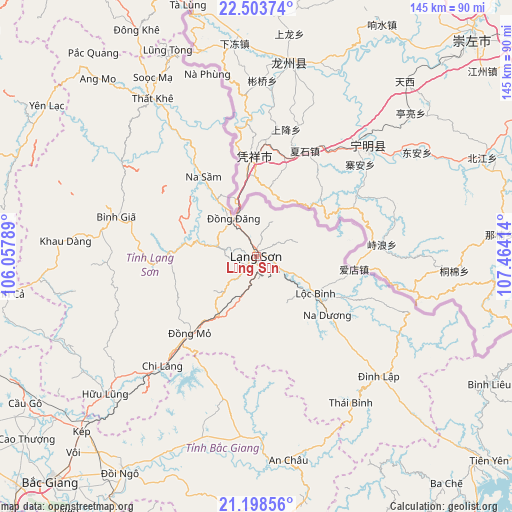
Lạng Sơn GPS coordinates[2]
21° 51' 9.504" North, 106° 45' 39.636" East
| Map corner | latitude | longitude |
|---|---|---|
| Upper-left | 22.50374°, | 106.05789° |
| Center: | 21.85264°, | 106.76101° |
| Lower-right: | 21.19856°, | 107.46414° |
| Map W x H: | 145.1×145.1 km | = 90.2×90.2mi |
| max Lat: | 23.27841° ⇑10.6% North |
| Lạng Sơn: | 21.85264° |
| min Lat: | ⇓89.4% South 8.65724° |
| min Long | Lạng Sơn | max Long |
| 102.4579° | 106.76101° | 112.72541° |
| W 70.8%⇐ | ⇒29.2% E |
Elevation
Elevation of Lạng Sơn is 265 m = 869 ft, and this is 135.5 m = 445 ft above average elevation for this country.
| Max E: |
1592 m = 5223 ft | 16.2% |
| Lạng Sơn | 265 m 869 ft | |
| Avg. | 129.5 m = 425 ft | |
Min E: |
-1 m = -3 ft | 83.8% |
See also: Lạng Sơn elevation on elevation.city.
Geographical zone
Lạng Sơn is located in North Torrid zone (between Equator and Tropic of Cancer). Distance of this Northern Tropic circle is 176.1 km =109.4 mi to North.| Distance of | km | miles | from Lạng Sơn |
|---|---|---|---|
| North Pole | 7577.3 | 4708.3 | to North |
| Arctic Circle | 4971.4 | 3089.1 | to North |
| Tropic Cancer | 176.1 | 109.4 | to North |
| Equator | 2429.8 | 1509.8 | to South |


Nearby cities:
15 places around Lạng Sơn: (largest is in red/bold)
• An Châu
58.3 km =36.2 mi,  170°
170°
• Bình Gia
42.6 km =26.5 mi,  286°
286°
• Bắc Sơn
45.7 km =28.4 mi,  276°
276°
• Chũ
56.9 km =35.4 mi,  200°
200°
• Hữu Lũng
57.8 km =35.9 mi,  228°
228°
• Lộc Bình
19.7 km =12.2 mi,  121°
121°
• Thị Trấn Cao Lộc
1.7 km =1.1 mi,  26°
26°
• Thị Trấn Na Sầm
27.2 km =16.9 mi,  326°
326°
• Thị Trấn Thất Khê
53.7 km =33.4 mi, 326°
• Thị Trấn Đông Khê
72.5 km =45 mi, 332°
• Văn Quan
22.9 km =14.2 mi,  273°
273°
• Yến Lạc
73.4 km =45.6 mi,  305°
305°
• Đình Lập
48.7 km =30.3 mi,  134°
134°
• Đồi Ngô
72 km =44.7 mi,  212°
212°
• Đồng Mỏ
28.8 km =17.9 mi,  220°
220°
Sources, notices
• [Note1] Compared only with cities in Vietnam existing in our database
• [Src1] Map data: © OpenStreetMap contributors (CC-BY-SA)
• [Src2] Other city data from geonames.org with taken over terms of usage.
• [Src3] Geographical zone / Annual Mean Temperature by Robert A. Rohde @ Wikipedia
