Thị Trấn Điện Biên geodata
Thị Trấn Điện Biên (Ðiện Biên) is a seat of a second-order administrative division; located in Vietnam in Asia/Ho_Chi_Minh (GMT+7) time zone. In our database, there are 94 cities with bigger population. Compared to other cities in Vietnam, 81.2% of cities are located further ↓South; 99.5% of cities are located further →East and 90.5% of cities have lower elevation than Thị Trấn Điện Biên. Note1


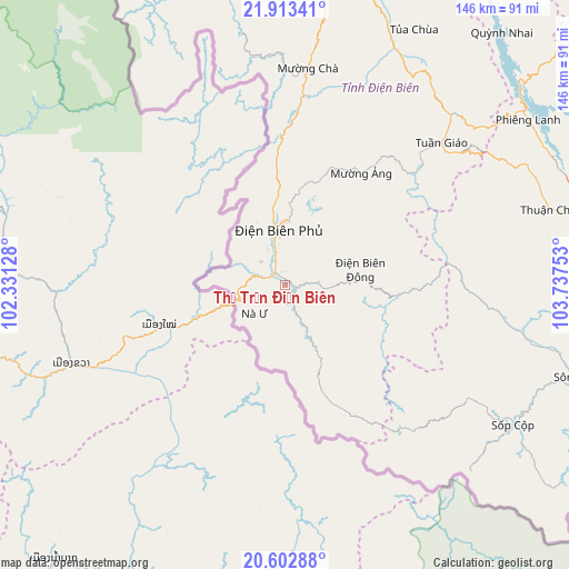
Thị Trấn Điện Biên GPS coordinates[2]
21° 15' 34.56" North, 103° 2' 3.84" East
| Map corner | latitude | longitude |
|---|---|---|
| Upper-left | 21.91341°, | 102.33128° |
| Center: | 21.2596°, | 103.0344° |
| Lower-right: | 20.60288°, | 103.73753° |
| Map W x H: | 145.7×145.7 km | = 90.5×90.5mi |
| max Lat: | 23.27841° ⇑18.8% North |
| Thị Trấn Điện Biên: | 21.2596° |
| min Lat: | ⇓81.2% South 8.65724° |
| min Long | Thị Trấn Đ | max Long |
| 102.4579° | 103.0344° | 112.72541° |
| W 0.5%⇐ | ⇒99.5% E |
Elevation
Elevation of Thị Trấn Điện Biên is 523 m = 1716 ft, and this is 393.5 m = 1291 ft above average elevation for this country.
| Max E: |
1592 m = 5223 ft | 9.5% |
| Thị Trấn Điện Biên | 523 m 1716 ft | |
| Avg. | 129.5 m = 425 ft | |
Min E: |
-1 m = -3 ft | 90.5% |
See also: Vietnam elevation on elevation.city.
Geographical zone
Thị Trấn Điện Biên is located in North Torrid zone (between Equator and Tropic of Cancer). Distance of this Northern Tropic circle is 242.1 km =150.4 mi to North.| Distance of | km | miles | from Thị Trấn Điện Biên |
|---|---|---|---|
| North Pole | 7643.2 | 4749.3 | to North |
| Arctic Circle | 5037.3 | 3130 | to North |
| Tropic Cancer | 242.1 | 150.4 | to North |
| Equator | 2363.8 | 1468.8 | to South |


Nearby cities:
15 places around Thị Trấn Điện Biên: (largest is in red/bold)
• Dien Bien Phu
14.1 km =8.8 mi,  355°
355°
• Hát Lót
111.3 km =69.2 mi,  93°
93°
• Mường Chiên
85 km =52.8 mi,  40°
40°
• Mường Chà
56.2 km =34.9 mi,  6°
6°
• Mường Nhé
119.6 km =74.3 mi,  330°
330°
• Mường Ảng
34.9 km =21.7 mi,  33°
33°
• Sông Mã
77.7 km =48.3 mi,  107°
107°
• Sơn La
91.9 km =57.1 mi, 85°
• Than Uyên
117 km =72.7 mi,  48°
48°
• Thị Trấn Sìn Hồ
124.8 km =77.5 mi, 9°
• Thị Trấn Thuận Châu
70.7 km =43.9 mi,  73°
73°
• Thị Trấn Tuần Giáo
54.4 km =33.8 mi, 47°
• Thị Trấn Tủa Chùa
73.7 km =45.8 mi, 25°
• Ít Ong
106.7 km =66.3 mi, 74°
• Điện Biên Đông
19.7 km =12.2 mi,  77°
77°
Sources, notices
• [Note1] Compared only with cities in Vietnam existing in our database
• [Src1] Map data: © OpenStreetMap contributors (CC-BY-SA)
• [Src2] Other city data from geonames.org with taken over terms of usage.
• [Src3] Geographical zone / Annual Mean Temperature by Robert A. Rohde @ Wikipedia
