Gia Nghĩa geodata
Gia Nghĩa (Ðắk Nông) is a seat of a first-order administrative division; located in Vietnam in Asia/Ho_Chi_Minh (GMT+7) time zone. In our database, there are 94 cities with bigger population. Compared to other cities in Vietnam, 67.4% of cities are located further ↑North; 80.6% of cities are located further ←West and 93.6% of cities have lower elevation than Gia Nghĩa. Note1


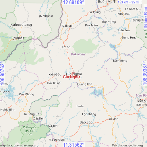
Gia Nghĩa GPS coordinates[2]
12° 0' 15.228" North, 107° 41' 26.664" East
| Map corner | latitude | longitude |
|---|---|---|
| Upper-left | 12.69109°, | 106.98762° |
| Center: | 12.00423°, | 107.69074° |
| Lower-right: | 11.31562°, | 108.39387° |
| Map W x H: | 152.9×152.9 km | = 95×95mi |
| max Lat: | 23.27841° ⇑67.4% North |
| Gia Nghĩa: | 12.00423° |
| min Lat: | ⇓32.6% South 8.65724° |
| min Long | Gia Nghĩa | max Long |
| 102.4579° | 107.69074° | 112.72541° |
| W 80.6%⇐ | ⇒19.4% E |
Elevation
Elevation of Gia Nghĩa is 616 m = 2021 ft, and this is 486.5 m = 1596 ft above average elevation for this country.
| Max E: |
1592 m = 5223 ft | 6.4% |
| Gia Nghĩa | 616 m 2021 ft | |
| Avg. | 129.5 m = 425 ft | |
Min E: |
-1 m = -3 ft | 93.6% |
See also: Vietnam elevation on elevation.city.
Geographical zone
Gia Nghĩa is located in North Torrid zone (between Equator and Tropic of Cancer). Distance of this Northern Tropic circle is 1271.2 km =789.9 mi to North.| Distance of | km | miles | from Gia Nghĩa |
|---|---|---|---|
| North Pole | 8672.3 | 5388.7 | to North |
| Arctic Circle | 6066.4 | 3769.5 | to North |
| Tropic Cancer | 1271.2 | 789.9 | to North |
| Equator | 1334.7 | 829.3 | to South |


Nearby cities:
15 places around Gia Nghĩa: (largest is in red/bold)
• Buôn Trấp
64.9 km =40.3 mi,  34°
34°
• Bảo Lộc
52.3 km =32.5 mi,  165°
165°
• Di Linh
63 km =39.1 mi,  138°
138°
• Ea T’ling
68.7 km =42.7 mi,  18°
18°
• Lạc Dương
79.2 km =49.2 mi,  90°
90°
• Lắk
69.5 km =43.2 mi,  49°
49°
• Lộc Thắng
44.6 km =27.7 mi,  159°
159°
• Ma Đa Gui
70.7 km =43.9 mi,  193°
193°
• Tram de Dak Mil
50.1 km =31.1 mi,  351°
351°
• Đinh Văn
64.8 km =40.3 mi,  111°
111°
• Đạ Tẻh
58.9 km =36.6 mi,  201°
201°
• Đắk Mâm
53.8 km =33.4 mi, 20°
• Đắk Song
29.3 km =18.2 mi,  342°
342°
• Đồng Nai
59 km =36.7 mi,  216°
216°
• Đức Phong
53 km =32.9 mi,  246°
246°
Sources, notices
• [Note1] Compared only with cities in Vietnam existing in our database
• [Src1] Map data: © OpenStreetMap contributors (CC-BY-SA)
• [Src2] Other city data from geonames.org with taken over terms of usage.
• [Src3] Geographical zone / Annual Mean Temperature by Robert A. Rohde @ Wikipedia
