Đức Phong geodata
Đức Phong (Bình Phước) is a seat of a second-order administrative division; located in Vietnam in Asia/Ho_Chi_Minh (GMT+7) time zone. In our database, there are 94 cities with bigger population. Compared to other cities in Vietnam, 68.5% of cities are located further ↑North; 76.8% of cities are located further ←West and 84.8% of cities have lower elevation than Đức Phong. Note1


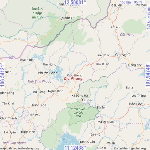
Đức Phong GPS coordinates[2]
11° 48' 48.456" North, 107° 14' 39.588" East
| Map corner | latitude | longitude |
|---|---|---|
| Upper-left | 12.50081°, | 106.54121° |
| Center: | 11.81346°, | 107.24433° |
| Lower-right: | 11.12438°, | 107.94746° |
| Map W x H: | 153×153 km | = 95.1×95.1mi |
| max Lat: | 23.27841° ⇑68.5% North |
| Đức Phong: | 11.81346° |
| min Lat: | ⇓31.5% South 8.65724° |
| min Long | Đức Phong | max Long |
| 102.4579° | 107.24433° | 112.72541° |
| W 76.8%⇐ | ⇒23.2% E |
Elevation
Elevation of Đức Phong is 284 m = 932 ft, and this is 154.5 m = 507 ft above average elevation for this country.
| Max E: |
1592 m = 5223 ft | 15.2% |
| Đức Phong | 284 m 932 ft | |
| Avg. | 129.5 m = 425 ft | |
Min E: |
-1 m = -3 ft | 84.8% |
See also: Vietnam elevation on elevation.city.
Geographical zone
Đức Phong is located in North Torrid zone (between Equator and Tropic of Cancer). Distance of this Northern Tropic circle is 1292.4 km =803.1 mi to North.| Distance of | km | miles | from Đức Phong |
|---|---|---|---|
| North Pole | 8693.5 | 5401.9 | to North |
| Arctic Circle | 6087.6 | 3782.7 | to North |
| Tropic Cancer | 1292.4 | 803.1 | to North |
| Equator | 1313.5 | 816.2 | to South |


Nearby cities:
15 places around Đức Phong: (largest is in red/bold)
• Bình Long
71.9 km =44.7 mi,  255°
255°
• Bù Đốp
50.8 km =31.6 mi,  288°
288°
• Bảo Lộc
68.1 km =42.3 mi,  115°
115°
• Chơn Thành
79 km =49.1 mi,  237°
237°
• Don Luan
50 km =31.1 mi,  231°
231°
• Gia Nghĩa
53 km =32.9 mi,  66°
66°
• Lộc Ninh
71.2 km =44.2 mi,  272°
272°
• Lộc Thắng
67.5 km =41.9 mi,  107°
107°
• Ma Đa Gui
57 km =35.4 mi,  146°
146°
• Tân Phú
57.5 km =35.7 mi, 225°
• Tân Phú
63.7 km =39.6 mi,  160°
160°
• Võ Xu
77.7 km =48.3 mi, 153°
• Đạ Tẻh
43 km =26.7 mi,  141°
141°
• Đắk Song
63.1 km =39.2 mi,  38°
38°
• Đồng Nai
29.1 km =18.1 mi, 153°
Sources, notices
• [Note1] Compared only with cities in Vietnam existing in our database
• [Src1] Map data: © OpenStreetMap contributors (CC-BY-SA)
• [Src2] Other city data from geonames.org with taken over terms of usage.
• [Src3] Geographical zone / Annual Mean Temperature by Robert A. Rohde @ Wikipedia
