Hoàn Lão geodata
Hoàn Lão (Quảng Bình) is a seat of a second-order administrative division; located in Vietnam in Asia/Ho_Chi_Minh (GMT+7) time zone. In our database, there are 94 cities with bigger population. Compared to other cities in Vietnam, 51.5% of cities are located further ↓South; 63.3% of cities are located further ←West and 61.7% of cities have higher elevation than Hoàn Lão. Note1


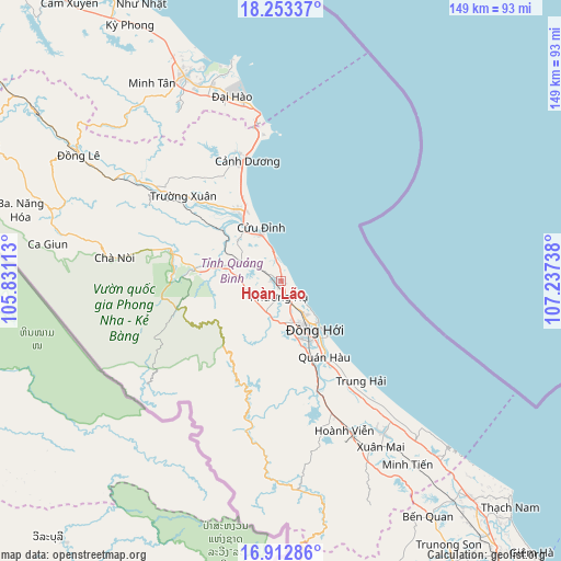
Hoàn Lão GPS coordinates[2]
17° 35' 3.696" North, 106° 32' 3.3" East
| Map corner | latitude | longitude |
|---|---|---|
| Upper-left | 18.25337°, | 105.83113° |
| Center: | 17.58436°, | 106.53425° |
| Lower-right: | 16.91286°, | 107.23738° |
| Map W x H: | 149.1×149.1 km | = 92.6×92.6mi |
| max Lat: | 23.27841° ⇑48.5% North |
| Hoàn Lão: | 17.58436° |
| min Lat: | ⇓51.5% South 8.65724° |
| min Long | Hoàn Lão | max Long |
| 102.4579° | 106.53425° | 112.72541° |
| W 63.3%⇐ | ⇒36.7% E |
Elevation
Elevation of Hoàn Lão is 10 m = 33 ft, and this is 119.5 m = 392 ft below average elevation for this country.
| Max E: |
1592 m = 5223 ft | 61.7% |
| Avg. | 129.5 m = 425 ft | |
| Hoàn Lão | 10 m = 33 ft | |
Min E: |
-1 m = -3 ft | 38.3% |
See also: Vietnam elevation on elevation.city.
Geographical zone
Hoàn Lão is located in North Torrid zone (between Equator and Tropic of Cancer). Distance of this Northern Tropic circle is 650.7 km =404.3 mi to North.| Distance of | km | miles | from Hoàn Lão |
|---|---|---|---|
| North Pole | 8051.9 | 5003.2 | to North |
| Arctic Circle | 5446 | 3384 | to North |
| Tropic Cancer | 650.7 | 404.3 | to North |
| Equator | 1955.2 | 1214.9 | to South |


Nearby cities:
15 places around Hoàn Lão: (largest is in red/bold)
• Ba Đồn
22.2 km =13.8 mi,  328°
328°
• Cam Lộ
99.2 km =61.6 mi,  150°
150°
• Cẩm Xuyên
93.1 km =57.8 mi,  322°
322°
• Gio Linh
93.8 km =58.3 mi,  141°
141°
• Hà Tĩnh
107.4 km =66.7 mi, 321°
• Hồ Xá
76.1 km =47.3 mi, 138°
• Khe Sanh
108.5 km =67.4 mi,  168°
168°
• Kiến Giang
48.5 km =30.1 mi, 145°
• Krông Klang
106.4 km =66.1 mi,  159°
159°
• Kwang Binh
15.9 km =9.9 mi, 143°
• Kỳ Anh
58.7 km =36.5 mi, 334°
• Oui Dat
64.5 km =40.1 mi,  292°
292°
• Quán Hàu
23 km =14.3 mi, 150°
• Ðông Hà
104.4 km =64.9 mi, 144°
• Đồng Lê
63.4 km =39.4 mi,  301°
301°
Sources, notices
• [Note1] Compared only with cities in Vietnam existing in our database
• [Src1] Map data: © OpenStreetMap contributors (CC-BY-SA)
• [Src2] Other city data from geonames.org with taken over terms of usage.
• [Src3] Geographical zone / Annual Mean Temperature by Robert A. Rohde @ Wikipedia
