Kỳ Anh geodata
Kỳ Anh (Hà Tĩnh) is a seat of a second-order administrative division; located in Vietnam in Asia/Ho_Chi_Minh (GMT+7) time zone. In our database, there are 94 cities with bigger population. Compared to other cities in Vietnam, 52.2% of cities are located further ↓South; 56% of cities are located further ←West and 58.4% of cities have lower elevation than Kỳ Anh. Note1


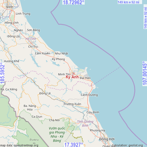
Kỳ Anh GPS coordinates[2]
18° 3' 44.748" North, 106° 17' 53.952" East
| Map corner | latitude | longitude |
|---|---|---|
| Upper-left | 18.72962°, | 105.5952° |
| Center: | 18.06243°, | 106.29832° |
| Lower-right: | 17.3927°, | 107.00145° |
| Map W x H: | 148.7×148.7 km | = 92.4×92.4mi |
| max Lat: | 23.27841° ⇑47.8% North |
| Kỳ Anh: | 18.06243° |
| min Lat: | ⇓52.2% South 8.65724° |
| min Long | Kỳ Anh | max Long |
| 102.4579° | 106.29832° | 112.72541° |
| W 56%⇐ | ⇒44% E |
Elevation
Elevation of Kỳ Anh is 21 m = 69 ft, and this is 108.5 m = 356 ft below average elevation for this country.
| Max E: |
1592 m = 5223 ft | 41.6% |
| Avg. | 129.5 m = 425 ft | |
| Kỳ Anh | 21 m = 69 ft | |
Min E: |
-1 m = -3 ft | 58.4% |
See also: Vietnam elevation on elevation.city.
Geographical zone
Kỳ Anh is located in North Torrid zone (between Equator and Tropic of Cancer). Distance of this Northern Tropic circle is 597.6 km =371.3 mi to North.| Distance of | km | miles | from Kỳ Anh |
|---|---|---|---|
| North Pole | 7998.7 | 4970.2 | to North |
| Arctic Circle | 5392.8 | 3350.9 | to North |
| Tropic Cancer | 597.6 | 371.3 | to North |
| Equator | 2008.4 | 1248 | to South |


Nearby cities:
15 places around Kỳ Anh: (largest is in red/bold)
• Ba Đồn
36.8 km =22.9 mi,  158°
158°
• Cẩm Xuyên
37.7 km =23.4 mi,  303°
303°
• Hoàn Lão
58.7 km =36.5 mi,  154°
154°
• Hà Tĩnh
51.9 km =32.2 mi,  306°
306°
• Hương Khê
64.5 km =40.1 mi,  281°
281°
• Kwang Binh
74.4 km =46.2 mi, 152°
• Nghi Xuân
87.9 km =54.6 mi,  319°
319°
• Nghèn
69.8 km =43.4 mi, 308°
• Oui Dat
45 km =28 mi,  230°
230°
• Quán Hàu
81.7 km =50.8 mi, 153°
• Thạch Hà
57.3 km =35.6 mi, 306°
• Vinh
93.3 km =58 mi, 316°
• Vũ Quang
91 km =56.5 mi,  293°
293°
• Đồng Lê
35 km =21.7 mi,  235°
235°
• Đức Thọ
92.3 km =57.4 mi, 305°
Sources, notices
• [Note1] Compared only with cities in Vietnam existing in our database
• [Src1] Map data: © OpenStreetMap contributors (CC-BY-SA)
• [Src2] Other city data from geonames.org with taken over terms of usage.
• [Src3] Geographical zone / Annual Mean Temperature by Robert A. Rohde @ Wikipedia
