Maţarah geodata
Maţarah (Shabwah) is a seat of a second-order administrative division; located in Yemen in Asia/Aden (GMT+3) time zone. In our database, there are 51 cities with bigger population. Compared to other cities in Yemen, 67.5% of cities are located further ↓South; 86% of cities are located further ←West and 70.1% of cities have higher elevation than Maţarah. Note1


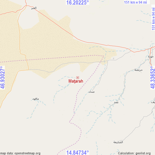
Maţarah GPS coordinates[2]
15° 31' 33.276" North, 47° 38' 0.204" East
| Map corner | latitude | longitude |
|---|---|---|
| Upper-left | 16.20225°, | 46.93027° |
| Center: | 15.52591°, | 47.63339° |
| Lower-right: | 14.84734°, | 48.33652° |
| Map W x H: | 150.7×150.7 km | = 93.6×93.6mi |
| max Lat: | 17.76999° ⇑32.5% North |
| Maţarah: | 15.52591° |
| min Lat: | ⇓67.5% South 12.18576° |
| min Long | Maţarah | max Long |
| 42.67107° | 47.63339° | 54.01895° |
| W 86%⇐ | ⇒14% E |
Elevation
Elevation of Maţarah is 838 m = 2749 ft, and this is 466.8 m = 1531 ft below average elevation for this country.
| Max E: |
2791 m = 9157 ft | 70.1% |
| Avg. | 1304.8 m = 4281 ft | |
| Maţarah | 838 m = 2749 ft | |
Min E: |
4 m = 13 ft | 29.9% |
See also: Yemen elevation on elevation.city.
Geographical zone
Maţarah is located in North Torrid zone (between Equator and Tropic of Cancer). Distance of this Northern Tropic circle is 879.6 km =546.6 mi to North.| Distance of | km | miles | from Maţarah |
|---|---|---|---|
| North Pole | 8280.7 | 5145.4 | to North |
| Arctic Circle | 5674.9 | 3526.2 | to North |
| Tropic Cancer | 879.6 | 546.6 | to North |
| Equator | 1726.3 | 1072.7 | to South |


Nearby cities:
15 places around Maţarah: (largest is in red/bold)
• Al Bāţinah
85.8 km =53.3 mi,  93°
93°
• Al Māfūd
45.7 km =28.4 mi,  243°
243°
• Al Qaţan
94.7 km =58.8 mi,  68°
68°
• Al Shirūj
94.6 km =58.8 mi,  171°
171°
• Al ‘Abr
80.2 km =49.8 mi,  327°
327°
• Ar Rawḑah
123.8 km =76.9 mi,  198°
198°
• Az̧ Z̧alī‘ah
70 km =43.5 mi,  144°
144°
• Aţ Ţalḩ
48.2 km =30 mi,  211°
211°
• Jawl al Majma‘
92.6 km =57.5 mi,  224°
224°
• Suḩayl Shibām
115.9 km =72 mi, 68°
• Şanā’
20 km =12.4 mi,  134°
134°
• Şīf
78.3 km =48.7 mi,  107°
107°
• Ḩajar al Mashā’ikh
71.5 km =44.4 mi,  17°
17°
• Ḩurayḑah
59.4 km =36.9 mi,  82°
82°
• ‘Amd
45.1 km =28 mi,  123°
123°
Sources, notices
• [Note1] Compared only with cities in Yemen existing in our database
• [Src1] Map data: © OpenStreetMap contributors (CC-BY-SA)
• [Src2] Other city data from geonames.org with taken over terms of usage.
• [Src3] Geographical zone / Annual Mean Temperature by Robert A. Rohde @ Wikipedia
