Majzar geodata
Majzar (Ma’rib) is a seat of a second-order administrative division; located in Yemen in Asia/Aden (GMT+3) time zone. In our database, there are 51 cities with bigger population. Compared to other cities in Yemen, 77.3% of cities are located further ↓South; 59.4% of cities are located further ←West and 55.8% of cities have higher elevation than Majzar. Note1


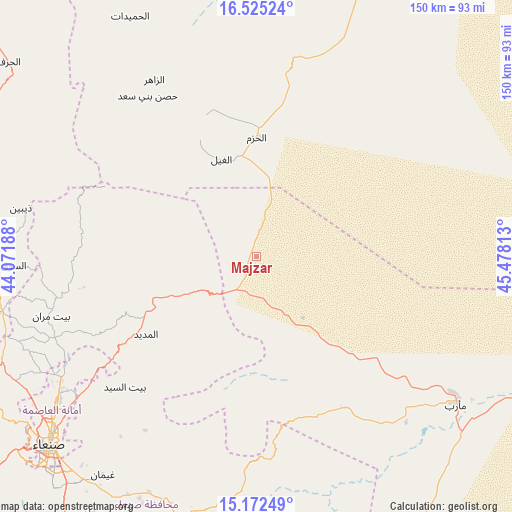
Majzar GPS coordinates[2]
15° 51' 0" North, 44° 46' 30" East
| Map corner | latitude | longitude |
|---|---|---|
| Upper-left | 16.52524°, | 44.07188° |
| Center: | 15.85°, | 44.775° |
| Lower-right: | 15.17249°, | 45.47813° |
| Map W x H: | 150.4×150.4 km | = 93.5×93.5mi |
| max Lat: | 17.76999° ⇑22.7% North |
| Majzar: | 15.85° |
| min Lat: | ⇓77.3% South 12.18576° |
| min Long | Majzar | max Long |
| 42.67107° | 44.775° | 54.01895° |
| W 59.4%⇐ | ⇒40.6% E |
Elevation
Elevation of Majzar is 1206 m = 3957 ft, and this is 98.8 m = 324 ft below average elevation for this country.
| Max E: |
2791 m = 9157 ft | 55.8% |
| Avg. | 1304.8 m = 4281 ft | |
| Majzar | 1206 m = 3957 ft | |
Min E: |
4 m = 13 ft | 44.2% |
See also: Yemen elevation on elevation.city.
Geographical zone
Majzar is located in North Torrid zone (between Equator and Tropic of Cancer). Distance of this Northern Tropic circle is 843.6 km =524.2 mi to North.| Distance of | km | miles | from Majzar |
|---|---|---|---|
| North Pole | 8244.7 | 5123 | to North |
| Arctic Circle | 5638.8 | 3503.8 | to North |
| Tropic Cancer | 843.6 | 524.2 | to North |
| Equator | 1762.4 | 1095.1 | to South |


Nearby cities:
15 places around Majzar: (largest is in red/bold)
• Al Ghayl
30.4 km =18.9 mi,  340°
340°
• Al Madīd
39.5 km =24.5 mi,  234°
234°
• Al Matūn
47 km =29.2 mi,  334°
334°
• Al Maşlūb
40.3 km =25 mi, 336°
• Al Ḩarjah
41.8 km =26 mi,  196°
196°
• Al Ḩayfah
58.9 km =36.6 mi,  257°
257°
• Al Ḩazm
34.9 km =21.7 mi,  0°
0°
• Ar Rawḑ
23.8 km =14.8 mi,  9°
9°
• Asdās
34.1 km =21.2 mi,  105°
105°
• Az Zāhir
60 km =37.3 mi, 330°
• Bayt Marrān
63.4 km =39.4 mi,  254°
254°
• Bidbadah
47.9 km =29.8 mi,  189°
189°
• Madghil
39.8 km =24.7 mi,  134°
134°
• Sūq Şirwāḩ
51.6 km =32.1 mi,  149°
149°
• Ḩişn Banī Sa‘d
56.8 km =35.3 mi, 325°
Sources, notices
• [Note1] Compared only with cities in Yemen existing in our database
• [Src1] Map data: © OpenStreetMap contributors (CC-BY-SA)
• [Src2] Other city data from geonames.org with taken over terms of usage.
• [Src3] Geographical zone / Annual Mean Temperature by Robert A. Rohde @ Wikipedia
