Ḩarīb geodata
Ḩarīb (Ma’rib) is a seat of a second-order administrative division; located in Yemen in Asia/Aden (GMT+3) time zone. In our database, there are 51 cities with bigger population. Compared to other cities in Yemen, 51.3% of cities are located further ↓South; 75% of cities are located further ←West and 59.4% of cities have higher elevation than Ḩarīb. Note1


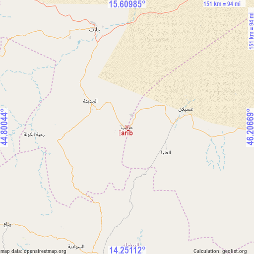
Ḩarīb GPS coordinates[2]
14° 55' 53.616" North, 45° 30' 12.816" East
| Map corner | latitude | longitude |
|---|---|---|
| Upper-left | 15.60985°, | 44.80044° |
| Center: | 14.93156°, | 45.50356° |
| Lower-right: | 14.25112°, | 46.20669° |
| Map W x H: | 151.1×151.1 km | = 93.9×93.9mi |
| max Lat: | 17.76999° ⇑48.7% North |
| Ḩarīb: | 14.93156° |
| min Lat: | ⇓51.3% South 12.18576° |
| min Long | Ḩarīb | max Long |
| 42.67107° | 45.50356° | 54.01895° |
| W 75%⇐ | ⇒25% E |
Elevation
Elevation of Ḩarīb is 1161 m = 3809 ft, and this is 143.8 m = 472 ft below average elevation for this country.
| Max E: |
2791 m = 9157 ft | 59.4% |
| Avg. | 1304.8 m = 4281 ft | |
| Ḩarīb | 1161 m = 3809 ft | |
Min E: |
4 m = 13 ft | 40.6% |
See also: Yemen elevation on elevation.city.
Geographical zone
Ḩarīb is located in North Torrid zone (between Equator and Tropic of Cancer). Distance of this Northern Tropic circle is 945.7 km =587.6 mi to North.| Distance of | km | miles | from Ḩarīb |
|---|---|---|---|
| North Pole | 8346.8 | 5186.5 | to North |
| Arctic Circle | 5740.9 | 3567.2 | to North |
| Tropic Cancer | 945.7 | 587.6 | to North |
| Equator | 1660.2 | 1031.6 | to South |


Nearby cities:
15 places around Ḩarīb: (largest is in red/bold)
• Al Aqţa‘
34.1 km =21.2 mi,  208°
208°
• Al Ghaylah
38.3 km =23.8 mi,  167°
167°
• Al Ḩajab
9.3 km =5.8 mi,  162°
162°
• Al Ḩazm
29.3 km =18.2 mi, 157°
• Al Ḩuşūn
62.1 km =38.6 mi,  346°
346°
• Al ‘Amūd
39.6 km =24.6 mi,  233°
233°
• Al ‘Āqir
59.6 km =37 mi,  132°
132°
• An Najd
60.9 km =37.8 mi,  201°
201°
• As Sawādīyah
76.4 km =47.5 mi, 203°
• Bayḩān
27.3 km =17 mi,  122°
122°
• Judaydah
27.1 km =16.8 mi,  306°
306°
• Ma'rib
62 km =38.5 mi,  342°
342°
• Maswarah
69.6 km =43.2 mi, 159°
• Raḩabah
55.4 km =34.4 mi,  265°
265°
• ‘Usaylān
36.6 km =22.7 mi,  72°
72°
Sources, notices
• [Note1] Compared only with cities in Yemen existing in our database
• [Src1] Map data: © OpenStreetMap contributors (CC-BY-SA)
• [Src2] Other city data from geonames.org with taken over terms of usage.
• [Src3] Geographical zone / Annual Mean Temperature by Robert A. Rohde @ Wikipedia
