Judaydah geodata
Judaydah (Ma’rib) is a seat of a second-order administrative division; located in Yemen in Asia/Aden (GMT+3) time zone. In our database, there are 51 cities with bigger population. Compared to other cities in Yemen, 54.5% of cities are located further ↓South; 71.1% of cities are located further ←West and 53.2% of cities have higher elevation than Judaydah. Note1


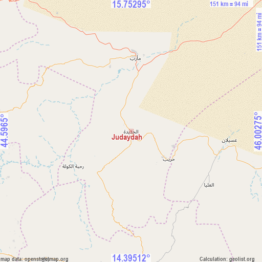
Judaydah GPS coordinates[2]
15° 4' 30.432" North, 45° 17' 58.632" East
| Map corner | latitude | longitude |
|---|---|---|
| Upper-left | 15.75295°, | 44.5965° |
| Center: | 15.07512°, | 45.29962° |
| Lower-right: | 14.39512°, | 46.00275° |
| Map W x H: | 151×151 km | = 93.8×93.8mi |
| max Lat: | 17.76999° ⇑45.5% North |
| Judaydah: | 15.07512° |
| min Lat: | ⇓54.5% South 12.18576° |
| min Long | Judaydah | max Long |
| 42.67107° | 45.29962° | 54.01895° |
| W 71.1%⇐ | ⇒28.9% E |
Elevation
Elevation of Judaydah is 1256 m = 4121 ft, and this is 48.8 m = 160 ft below average elevation for this country.
| Max E: |
2791 m = 9157 ft | 53.2% |
| Avg. | 1304.8 m = 4281 ft | |
| Judaydah | 1256 m = 4121 ft | |
Min E: |
4 m = 13 ft | 46.8% |
See also: Yemen elevation on elevation.city.
Geographical zone
Judaydah is located in North Torrid zone (between Equator and Tropic of Cancer). Distance of this Northern Tropic circle is 929.7 km =577.7 mi to North.| Distance of | km | miles | from Judaydah |
|---|---|---|---|
| North Pole | 8330.9 | 5176.6 | to North |
| Arctic Circle | 5725 | 3557.3 | to North |
| Tropic Cancer | 929.7 | 577.7 | to North |
| Equator | 1676.2 | 1041.5 | to South |


Nearby cities:
15 places around Judaydah: (largest is in red/bold)
• Al Aqţa‘
46.2 km =28.7 mi,  173°
173°
• Al Ghaylah
61.4 km =38.2 mi,  150°
150°
• Al Ḩajab
35 km =21.7 mi,  135°
135°
• Al Ḩazm
54.3 km =33.7 mi, 142°
• Al Ḩuşūn
44.9 km =27.9 mi,  9°
9°
• Al ‘Amūd
40.6 km =25.2 mi,  194°
194°
• An Najd
72.7 km =45.2 mi,  180°
180°
• Bayḩān
54.4 km =33.8 mi,  124°
124°
• Bidbadah
75.2 km =46.7 mi,  301°
301°
• Ma'rib
43.2 km =26.8 mi,  3°
3°
• Madghil
64.5 km =40.1 mi,  334°
334°
• Raḩabah
38.9 km =24.2 mi,  239°
239°
• Sūq Şirwāḩ
51.4 km =31.9 mi,  324°
324°
• Ḩarīb
27.1 km =16.8 mi,  126°
126°
• ‘Usaylān
57 km =35.4 mi,  94°
94°
Sources, notices
• [Note1] Compared only with cities in Yemen existing in our database
• [Src1] Map data: © OpenStreetMap contributors (CC-BY-SA)
• [Src2] Other city data from geonames.org with taken over terms of usage.
• [Src3] Geographical zone / Annual Mean Temperature by Robert A. Rohde @ Wikipedia
