Raḩabah geodata
Raḩabah (Ma’rib) is a seat of a second-order administrative division; located in Yemen in Asia/Aden (GMT+3) time zone. In our database, there are 51 cities with bigger population. Compared to other cities in Yemen, 50.6% of cities are located further ↓South; 65.6% of cities are located further ←West and 56.2% of cities have lower elevation than Raḩabah. Note1


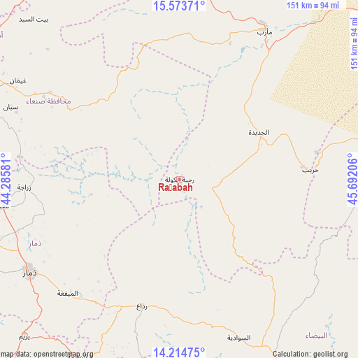
Raḩabah GPS coordinates[2]
14° 53' 43.08" North, 44° 59' 20.148" East
| Map corner | latitude | longitude |
|---|---|---|
| Upper-left | 15.57371°, | 44.28581° |
| Center: | 14.8953°, | 44.98893° |
| Lower-right: | 14.21475°, | 45.69206° |
| Map W x H: | 151.1×151.1 km | = 93.9×93.9mi |
| max Lat: | 17.76999° ⇑49.4% North |
| Raḩabah: | 14.8953° |
| min Lat: | ⇓50.6% South 12.18576° |
| min Long | Raḩabah | max Long |
| 42.67107° | 44.98893° | 54.01895° |
| W 65.6%⇐ | ⇒34.4% E |
Elevation
Elevation of Raḩabah is 1483 m = 4865 ft, and this is 178.2 m = 585 ft above average elevation for this country.
| Max E: |
2791 m = 9157 ft | 43.8% |
| Raḩabah | 1483 m 4865 ft | |
| Avg. | 1304.8 m = 4281 ft | |
Min E: |
4 m = 13 ft | 56.2% |
See also: Yemen elevation on elevation.city.
Geographical zone
Raḩabah is located in North Torrid zone (between Equator and Tropic of Cancer). Distance of this Northern Tropic circle is 949.7 km =590.1 mi to North.| Distance of | km | miles | from Raḩabah |
|---|---|---|---|
| North Pole | 8350.9 | 5189 | to North |
| Arctic Circle | 5745 | 3569.8 | to North |
| Tropic Cancer | 949.7 | 590.1 | to North |
| Equator | 1656.2 | 1029.1 | to South |


Nearby cities:
15 places around Raḩabah: (largest is in red/bold)
• Al Aqţa‘
46.8 km =29.1 mi,  123°
123°
• Al Mayfa’ah
67.4 km =41.9 mi,  224°
224°
• Al Qurayshīyah
45 km =28 mi,  198°
198°
• Al Ḩajab
58.2 km =36.2 mi,  94°
94°
• Al ‘Amūd
30.4 km =18.9 mi,  129°
129°
• An Najd
62.2 km =38.6 mi,  147°
147°
• Ash Sharyah
60 km =37.3 mi,  176°
176°
• Bidbadah
66.6 km =41.4 mi,  332°
332°
• Jiḩānah
65.7 km =40.8 mi,  304°
304°
• Judaydah
38.9 km =24.2 mi,  59°
59°
• Milāḩ
57.6 km =35.8 mi, 202°
• Radā‘
55.8 km =34.7 mi, 197°
• Sūq Şirwāḩ
61.7 km =38.3 mi,  2°
2°
• Zarājah
65.7 km =40.8 mi,  267°
267°
• Ḩarīb
55.4 km =34.4 mi, 85°
Sources, notices
• [Note1] Compared only with cities in Yemen existing in our database
• [Src1] Map data: © OpenStreetMap contributors (CC-BY-SA)
• [Src2] Other city data from geonames.org with taken over terms of usage.
• [Src3] Geographical zone / Annual Mean Temperature by Robert A. Rohde @ Wikipedia
