Al Burayqah geodata
Al Burayqah (Aden) is a seat of a second-order administrative division; located in Yemen in Asia/Aden (GMT+3) time zone. In our database, there are 51 cities with bigger population. Compared to other cities in Yemen, 99% of cities are located further ↑North; 64.3% of cities are located further ←West and 94.8% of cities have higher elevation than Al Burayqah. Note1


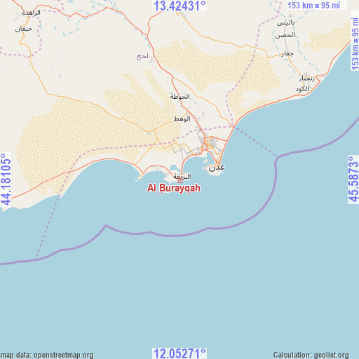
Al Burayqah GPS coordinates[2]
12° 44' 21.984" North, 44° 53' 3.012" East
| Map corner | latitude | longitude |
|---|---|---|
| Upper-left | 13.42431°, | 44.18105° |
| Center: | 12.73944°, | 44.88417° |
| Lower-right: | 12.05271°, | 45.5873° |
| Map W x H: | 152.5×152.5 km | = 94.8×94.8mi |
| max Lat: | 17.76999° ⇑99% North |
| Al Burayqah: | 12.73944° |
| min Lat: | ⇓1% South 12.18576° |
| min Long | Al Burayqah | max Long |
| 42.67107° | 44.88417° | 54.01895° |
| W 64.3%⇐ | ⇒35.7% E |
Elevation
Elevation of Al Burayqah is 14 m = 46 ft, and this is 1290.8 m = 4235 ft below average elevation for this country.
| Max E: |
2791 m = 9157 ft | 94.8% |
| Avg. | 1304.8 m = 4281 ft | |
| Al Burayqah | 14 m = 46 ft | |
Min E: |
4 m = 13 ft | 5.2% |
See also: Yemen elevation on elevation.city.
Geographical zone
Al Burayqah is located in North Torrid zone (between Equator and Tropic of Cancer). Distance of this Northern Tropic circle is 1189.4 km =739.1 mi to North.| Distance of | km | miles | from Al Burayqah |
|---|---|---|---|
| North Pole | 8590.6 | 5337.9 | to North |
| Arctic Circle | 5984.7 | 3718.7 | to North |
| Tropic Cancer | 1189.4 | 739.1 | to North |
| Equator | 1416.5 | 880.2 | to South |


Nearby cities:
15 places around Al Burayqah: (largest is in red/bold)
• Aden
17.1 km =10.6 mi,  74°
74°
• Al Manşūrah
17.1 km =10.6 mi,  38°
38°
• Al Ma‘allā’
14 km =8.7 mi, 66°
• Al Milāḩ
76.6 km =47.6 mi,  355°
355°
• Al Musaymīr
83.6 km =51.9 mi,  339°
339°
• Ash Shaykh ‘Uthmān
19.3 km =12 mi, 37°
• At Tawāhī
11.6 km =7.2 mi,  64°
64°
• Crater
17.2 km =10.7 mi,  76°
76°
• Ja‘ār
70.5 km =43.8 mi, 40°
• Khawr Maksar
18.1 km =11.2 mi, 63°
• Kirsh
81.6 km =50.7 mi,  328°
328°
• Laḩij
35.3 km =21.9 mi, 359°
• Zinjibār
69.1 km =42.9 mi,  51°
51°
• Ţawr al Bāḩah
80.2 km =49.8 mi,  307°
307°
• Ḩadādah
81.9 km =50.9 mi, 306°
Sources, notices
• [Note1] Compared only with cities in Yemen existing in our database
• [Src1] Map data: © OpenStreetMap contributors (CC-BY-SA)
• [Src2] Other city data from geonames.org with taken over terms of usage.
• [Src3] Geographical zone / Annual Mean Temperature by Robert A. Rohde @ Wikipedia
