Ash Sharyah geodata
Ash Sharyah (Al Bayda) is a seat of a second-order administrative division; located in Yemen in Asia/Aden (GMT+3) time zone. In our database, there are 51 cities with bigger population. Compared to other cities in Yemen, 63.6% of cities are located further ↑North; 66.9% of cities are located further ←West and 74.7% of cities have lower elevation than Ash Sharyah. Note1


Ash Sharyah GPS coordinates[2]
14° 21' 23.724" North, 45° 1' 20.784" East
| Map corner | latitude | longitude |
|---|---|---|
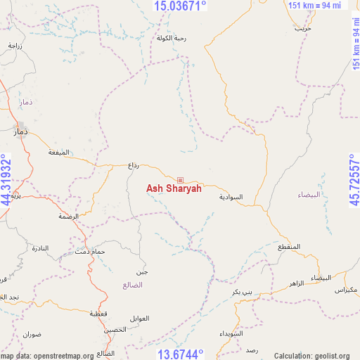
| Upper-left | 15.03671°, | 44.31932° |
| Center: | 14.35659°, | 45.02244° |
| Lower-right: | 13.6744°, | 45.72557° |
| Map W x H: | 151.5×151.5 km | = 94.1×94.1mi |
| max Lat: | 17.76999° ⇑63.6% North |
| Ash Sharyah: | 14.35659° |
| min Lat: | ⇓36.4% South 12.18576° |
| min Long | Ash Sharyah | max Long |
| 42.67107° | 45.02244° | 54.01895° |
| W 66.9%⇐ | ⇒33.1% E |
Elevation
Elevation of Ash Sharyah is 2010 m = 6594 ft, and this is 705.2 m = 2314 ft above average elevation for this country.
| Max E: |
2791 m = 9157 ft | 25.3% |
| Ash Sharyah | 2010 m 6594 ft | |
| Avg. | 1304.8 m = 4281 ft | |
Min E: |
4 m = 13 ft | 74.7% |
See also: Yemen elevation on elevation.city.
Geographical zone
Ash Sharyah is located in North Torrid zone (between Equator and Tropic of Cancer). Distance of this Northern Tropic circle is 1009.6 km =627.3 mi to North.| Distance of | km | miles | from Ash Sharyah |
|---|---|---|---|
| North Pole | 8410.8 | 5226.2 | to North |
| Arctic Circle | 5804.9 | 3607 | to North |
| Tropic Cancer | 1009.6 | 627.3 | to North |
| Equator | 1596.3 | 991.9 | to South |


Nearby cities:
15 places around Ash Sharyah: (largest is in red/bold)
• Al Aqţa‘
49.1 km =30.5 mi,  46°
46°
• Al Mayfa’ah
52.4 km =32.6 mi,  283°
283°
• Al Qurayshīyah
25.1 km =15.6 mi,  313°
313°
• Al ‘Amūd
45.1 km =28 mi,  26°
26°
• Al ‘Aqabah
27.1 km =16.8 mi,  249°
249°
• An Najd
30.3 km =18.8 mi,  76°
76°
• Ar Raḑmah
49.4 km =30.7 mi, 252°
• As Sawādīyah
22.3 km =13.9 mi,  106°
106°
• Dhī Nā‘im
53.7 km =33.4 mi,  121°
121°
• Juban
41.5 km =25.8 mi,  202°
202°
• Milāḩ
26.3 km =16.3 mi, 284°
• Radā‘
21 km =13 mi,  288°
288°
• Zakhim
37 km =23 mi,  259°
259°
• Āl Ma‘ūdah
42.5 km =26.4 mi, 112°
• Ḩammām Damt
48.2 km =30 mi,  232°
232°
Sources, notices
• [Note1] Compared only with cities in Yemen existing in our database
• [Src1] Map data: © OpenStreetMap contributors (CC-BY-SA)
• [Src2] Other city data from geonames.org with taken over terms of usage.
• [Src3] Geographical zone / Annual Mean Temperature by Robert A. Rohde @ Wikipedia
