AL-khashā upper geodata
AL-khashā upper (Shabwah) is a populated place; located in Yemen in Asia/Aden (GMT+3) time zone. With population of 1,100 people, there are 37 cities with bigger population in this country. Compared to other cities in Yemen, 65.3% of cities are located further ↑North; 81.2% of cities are located further ←West and 51.6% of cities have lower elevation than AL-khashā upper. Note1


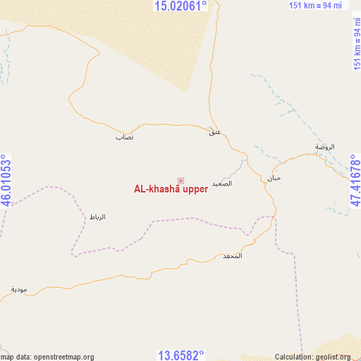
AL-khashā upper GPS coordinates[2]
14° 20' 25.584" North, 46° 42' 49.14" East
| Map corner | latitude | longitude |
|---|---|---|
| Upper-left | 15.02061°, | 46.01053° |
| Center: | 14.34044°, | 46.71365° |
| Lower-right: | 13.6582°, | 47.41678° |
| Map W x H: | 151.5×151.5 km | = 94.1×94.1mi |
| max Lat: | 17.76999° ⇑65.3% North |
| AL-khashā upper: | 14.34044° |
| min Lat: | ⇓34.7% South 12.18576° |
| min Long | AL-khashā uppe | max Long |
| 42.67107° | 46.71365° | 54.01895° |
| W 81.2%⇐ | ⇒18.8% E |
Elevation
Elevation of AL-khashā upper is 1323 m = 4341 ft, and this is 18.2 m = 60 ft above average elevation for this country.
| Max E: |
2791 m = 9157 ft | 48.4% |
| AL-khashā upper | 1323 m 4341 ft | |
| Avg. | 1304.8 m = 4281 ft | |
Min E: |
4 m = 13 ft | 51.6% |
See also: Yemen elevation on elevation.city.
Geographical zone
AL-khashā upper is located in North Torrid zone (between Equator and Tropic of Cancer). Distance of this Northern Tropic circle is 1011.4 km =628.5 mi to North.| Distance of | km | miles | from AL-khashā upper |
|---|---|---|---|
| North Pole | 8412.6 | 5227.3 | to North |
| Arctic Circle | 5806.7 | 3608.1 | to North |
| Tropic Cancer | 1011.4 | 628.5 | to North |
| Equator | 1594.5 | 990.8 | to South |


Nearby cities:
15 places around AL-khashā upper: (largest is in red/bold)
• AL-khashā Lower
2 km =1.2 mi,  68°
68°
• Al Maḩfid
38 km =23.6 mi,  145°
145°
• Al ‘Āqir
90 km =55.9 mi,  286°
286°
• Ar Rawḑah
62.2 km =38.6 mi,  76°
76°
• Ataq
25.4 km =15.8 mi,  30°
30°
• Jawl al Majma‘
74 km =46 mi, 27°
• Jayshān
58.4 km =36.3 mi,  260°
260°
• Khawrah
61.1 km =38 mi,  279°
279°
• Khimār
3.6 km =2.2 mi,  129°
129°
• Marbāţ
38.1 km =23.7 mi,  246°
246°
• Mūdīyah
82 km =51 mi,  236°
236°
• Nişāb
30.1 km =18.7 mi,  308°
308°
• Said
17.2 km =10.7 mi,  93°
93°
• Salābah
3 km =1.9 mi,  156°
156°
• Ḩabbān
39.1 km =24.3 mi, 87°
Sources, notices
• [Note1] Compared only with cities in Yemen existing in our database
• [Src1] Map data: © OpenStreetMap contributors (CC-BY-SA)
• [Src2] Other city data from geonames.org with taken over terms of usage.
• [Src3] Geographical zone / Annual Mean Temperature by Robert A. Rohde @ Wikipedia
