Ataq geodata
Ataq (Shabwah) is a seat of a first-order administrative division; located in Yemen in Asia/Aden (GMT+3) time zone. With population of 37,315 people, there are 15 cities with bigger population in this country. Compared to other cities in Yemen, 58.4% of cities are located further ↑North; 82.8% of cities are located further ←West and 60.1% of cities have higher elevation than Ataq. Note1


Ataq GPS coordinates[2]
14° 32' 15.612" North, 46° 49' 54.732" East
| Map corner | latitude | longitude |
|---|---|---|
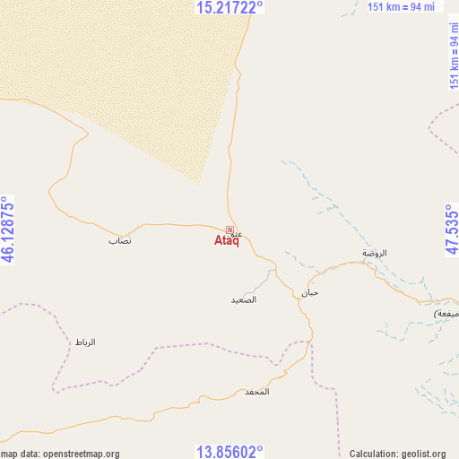
| Upper-left | 15.21722°, | 46.12875° |
| Center: | 14.53767°, | 46.83187° |
| Lower-right: | 13.85602°, | 47.535° |
| Map W x H: | 151.4×151.4 km | = 94.1×94.1mi |
| max Lat: | 17.76999° ⇑58.4% North |
| Ataq: | 14.53767° |
| min Lat: | ⇓41.6% South 12.18576° |
| min Long | Ataq | max Long |
| 42.67107° | 46.83187° | 54.01895° |
| W 82.8%⇐ | ⇒17.2% E |
Elevation
Elevation of Ataq is 1148 m = 3766 ft, and this is 156.8 m = 514 ft below average elevation for this country.
| Max E: |
2791 m = 9157 ft | 60.1% |
| Avg. | 1304.8 m = 4281 ft | |
| Ataq | 1148 m = 3766 ft | |
Min E: |
4 m = 13 ft | 39.9% |
See also: Yemen elevation on elevation.city.
Geographical zone
Ataq is located in North Torrid zone (between Equator and Tropic of Cancer). Distance of this Northern Tropic circle is 989.5 km =614.8 mi to North.| Distance of | km | miles | from Ataq |
|---|---|---|---|
| North Pole | 8390.6 | 5213.7 | to North |
| Arctic Circle | 5784.7 | 3594.4 | to North |
| Tropic Cancer | 989.5 | 614.8 | to North |
| Equator | 1616.4 | 1004.4 | to South |


Nearby cities:
15 places around Ataq: (largest is in red/bold)
• AL-khashā Lower
23.8 km =14.8 mi,  207°
207°
• AL-khashā upper
25.4 km =15.8 mi, 210°
• Al Maḩfid
54 km =33.6 mi,  170°
170°
• Ar Rawḑah
48.5 km =30.1 mi,  99°
99°
• Aţ Ţalḩ
91.9 km =57.1 mi,  41°
41°
• Jawl al Majma‘
48.7 km =30.3 mi,  25°
25°
• Jayshān
77.1 km =47.9 mi,  245°
245°
• Khawrah
73.9 km =45.9 mi,  260°
260°
• Khimār
26.2 km =16.3 mi,  202°
202°
• Marbāţ
60.4 km =37.5 mi,  232°
232°
• Mayfa‘ah
86.1 km =53.5 mi,  109°
109°
• Nişāb
36.6 km =22.7 mi, 264°
• Said
23.5 km =14.6 mi, 169°
• Salābah
27.2 km =16.9 mi, 205°
• Ḩabbān
33.3 km =20.7 mi,  127°
127°
Sources, notices
• [Note1] Compared only with cities in Yemen existing in our database
• [Src1] Map data: © OpenStreetMap contributors (CC-BY-SA)
• [Src2] Other city data from geonames.org with taken over terms of usage.
• [Src3] Geographical zone / Annual Mean Temperature by Robert A. Rohde @ Wikipedia
