Ḩabbān geodata
Ḩabbān (Shabwah) is a seat of a second-order administrative division; located in Yemen in Asia/Aden (GMT+3) time zone. In our database, there are 51 cities with bigger population. Compared to other cities in Yemen, 64% of cities are located further ↑North; 84.1% of cities are located further ←West and 66.9% of cities have higher elevation than Ḩabbān. Note1


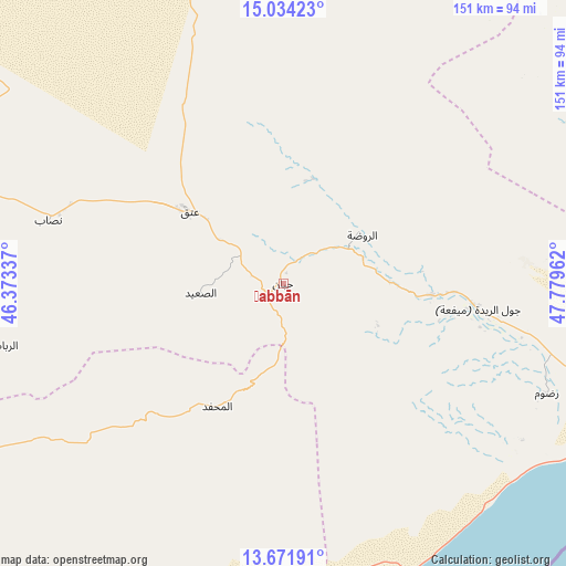
Ḩabbān GPS coordinates[2]
14° 21' 14.796" North, 47° 4' 35.364" East
| Map corner | latitude | longitude |
|---|---|---|
| Upper-left | 15.03423°, | 46.37337° |
| Center: | 14.35411°, | 47.07649° |
| Lower-right: | 13.67191°, | 47.77962° |
| Map W x H: | 151.5×151.5 km | = 94.1×94.1mi |
| max Lat: | 17.76999° ⇑64% North |
| Ḩabbān: | 14.35411° |
| min Lat: | ⇓36% South 12.18576° |
| min Long | Ḩabbān | max Long |
| 42.67107° | 47.07649° | 54.01895° |
| W 84.1%⇐ | ⇒15.9% E |
Elevation
Elevation of Ḩabbān is 973 m = 3192 ft, and this is 331.8 m = 1089 ft below average elevation for this country.
| Max E: |
2791 m = 9157 ft | 66.9% |
| Avg. | 1304.8 m = 4281 ft | |
| Ḩabbān | 973 m = 3192 ft | |
Min E: |
4 m = 13 ft | 33.1% |
See also: Yemen elevation on elevation.city.
Geographical zone
Ḩabbān is located in North Torrid zone (between Equator and Tropic of Cancer). Distance of this Northern Tropic circle is 1009.9 km =627.5 mi to North.| Distance of | km | miles | from Ḩabbān |
|---|---|---|---|
| North Pole | 8411 | 5226.4 | to North |
| Arctic Circle | 5805.1 | 3607.1 | to North |
| Tropic Cancer | 1009.9 | 627.5 | to North |
| Equator | 1596 | 991.7 | to South |


Nearby cities:
15 places around Ḩabbān: (largest is in red/bold)
• AL-khashā Lower
37.2 km =23.1 mi,  268°
268°
• AL-khashā upper
39.1 km =24.3 mi, 267°
• Al Maḩfid
37.3 km =23.2 mi,  208°
208°
• Al Shirūj
83.2 km =51.7 mi,  63°
63°
• Ar Rawḑah
24.9 km =15.5 mi, 59°
• Ataq
33.3 km =20.7 mi,  307°
307°
• Aţ Ţalḩ
95.7 km =59.5 mi,  21°
21°
• Jawl al Majma‘
64.6 km =40.1 mi,  355°
355°
• Khimār
36.5 km =22.7 mi,  264°
264°
• Marbāţ
76 km =47.2 mi, 257°
• Mayfa‘ah
55.4 km =34.4 mi,  99°
99°
• Nişāb
65.1 km =40.5 mi,  285°
285°
• Ruḑūm
77.8 km =48.3 mi,  112°
112°
• Said
22.1 km =13.7 mi, 263°
• Salābah
38.1 km =23.7 mi, 263°
Sources, notices
• [Note1] Compared only with cities in Yemen existing in our database
• [Src1] Map data: © OpenStreetMap contributors (CC-BY-SA)
• [Src2] Other city data from geonames.org with taken over terms of usage.
• [Src3] Geographical zone / Annual Mean Temperature by Robert A. Rohde @ Wikipedia
