Tongaat Beach geodata
Tongaat Beach (KwaZulu-Natal) is a populated place; located in South Africa in Africa/Johannesburg (GMT+2) time zone. With population of 722 people, there are 256 cities with bigger population in this country. Compared to other cities in South Africa, 61.9% of cities are located further ↑North; 94.1% of cities are located further ←West and 92% of cities have higher elevation than Tongaat Beach. Note1
Administrative division(s):
- Level 1: KwaZulu-Natal
- Level 2: eThekwini Metropolitan Municipality
- Level 3: Ethekwini


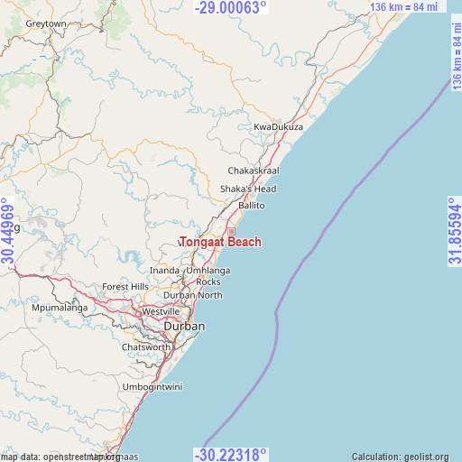
Tongaat Beach GPS coordinates[2]
29° 36' 49.536" South, 31° 9' 10.116" East
| Map corner | latitude | longitude |
|---|---|---|
| Upper-left | -29.00063°, | 30.44969° |
| Center: | -29.61376°, | 31.15281° |
| Lower-right: | -30.22318°, | 31.85594° |
| Map W x H: | 135.9×135.9 km | = 84.4×84.4mi |
| max Lat: | -22.34881° ⇑61.9% North |
| Tongaat Beach: | -29.61376° |
| min Lat: | ⇓38.1% South -34.66739° |
| min Long | Tongaat Beach | max Long |
| 16.8697° | 31.15281° | 32.26762° |
| W 94.1%⇐ | ⇒5.9% E |
Elevation
Elevation of Tongaat Beach is 65 m = 213 ft, and this is 904.6 m = 2968 ft below average elevation for this country.
| Max E: |
1873 m = 6145 ft | 92% |
| Avg. | 969.6 m = 3181 ft | |
| Tongaat Beach | 65 m = 213 ft | |
Min E: |
7 m = 23 ft | 8% |
See also: South Africa elevation on elevation.city.
Geographical zone
Tongaat Beach is located in South temperate zone (between Tropic of Capricorn and the Antarctic Circle). Distance of this Southern Tropic circle is 686.8 km =426.8 mi to North.| Distance of | km | miles | from Tongaat Beach |
|---|---|---|---|
| Equator | 3292.7 | 2046 | to North |
| Tropic Capricorn | 686.8 | 426.8 | to North |
| Antarctic Circle | 4108.4 | 2552.8 | to South |
| South Pole | 6714.3 | 4172.1 | to South |


Nearby cities:
15 places around Tongaat Beach: (largest is in red/bold)
• Ballito
10.2 km =6.3 mi,  35°
35°
• Berea
30.6 km =19 mi,  210°
210°
• Camperdown
60.3 km =37.5 mi,  257°
257°
• Durban
29.7 km =18.5 mi,  203°
203°
• Eshowe
86.5 km =53.7 mi,  20°
20°
• Greytown
81.7 km =50.8 mi,  318°
318°
• KwaDukuza
34.4 km =21.4 mi, 22°
• Mandeni
57.8 km =35.9 mi,  25°
25°
• Mpumalanga
54.6 km =33.9 mi,  246°
246°
• Ndwedwe
24.4 km =15.2 mi,  296°
296°
• Pietermaritzburg
73.5 km =45.7 mi,  269°
269°
• Scottburgh
84.1 km =52.3 mi, 207°
• Sundumbili
58.4 km =36.3 mi, 23°
• Wartburg
59.4 km =36.9 mi,  289°
289°
• eMkhomazi
74.3 km =46.2 mi, 207°
Sources, notices
• [Note1] Compared only with cities in South Africa existing in our database
• [Src1] Map data: © OpenStreetMap contributors (CC-BY-SA)
• [Src2] Other city data from geonames.org with taken over terms of usage.
• [Src3] Geographical zone / Annual Mean Temperature by Robert A. Rohde @ Wikipedia
