Port Shepstone geodata
Port Shepstone (KwaZulu-Natal) is a seat of a second-order administrative division; located in South Africa in Africa/Johannesburg (GMT+2) time zone. With population of 52,793 people, there are 91 cities with bigger population in this country. Compared to other cities in South Africa, 70.5% of cities are located further ↑North; 87.3% of cities are located further ←West and 94.7% of cities have higher elevation than Port Shepstone. Note1
Administrative division(s):
- Level 1: KwaZulu-Natal
- Level 2: Ugu District Municipality
- Level 3: Hibiscus Coast


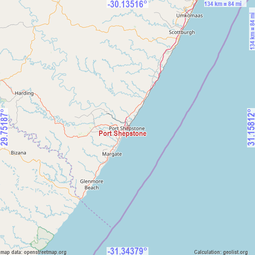
Port Shepstone GPS coordinates[2]
30° 44' 28.932" South, 30° 27' 17.964" East
| Map corner | latitude | longitude |
|---|---|---|
| Upper-left | -30.13516°, | 29.75187° |
| Center: | -30.74137°, | 30.45499° |
| Lower-right: | -31.34379°, | 31.15812° |
| Map W x H: | 134.4×134.4 km | = 83.5×83.5mi |
| max Lat: | -22.34881° ⇑70.5% North |
| Port Shepstone: | -30.74137° |
| min Lat: | ⇓29.5% South -34.66739° |
| min Long | Port Shepstone | max Long |
| 16.8697° | 30.45499° | 32.26762° |
| W 87.3%⇐ | ⇒12.7% E |
Elevation
Elevation of Port Shepstone is 36 m = 118 ft, and this is 933.6 m = 3063 ft below average elevation for this country.
| Max E: |
1873 m = 6145 ft | 94.7% |
| Avg. | 969.6 m = 3181 ft | |
| Port Shepstone | 36 m = 118 ft | |
Min E: |
7 m = 23 ft | 5.3% |
See also: Port Shepstone elevation on elevation.city.
Geographical zone
Port Shepstone is located in South temperate zone (between Tropic of Capricorn and the Antarctic Circle). Distance of this Southern Tropic circle is 812.2 km =504.7 mi to North.| Distance of | km | miles | from Port Shepstone |
|---|---|---|---|
| Equator | 3418.1 | 2123.9 | to North |
| Tropic Capricorn | 812.2 | 504.7 | to North |
| Antarctic Circle | 3983.1 | 2475 | to South |
| South Pole | 6588.9 | 4094.2 | to South |


Nearby cities:
15 places around Port Shepstone: (largest is in red/bold)
• Berea
111.6 km =69.3 mi,  27°
27°
• Bizana
58.9 km =36.6 mi,  257°
257°
• Creighton
98.9 km =61.5 mi,  323°
323°
• Durban
112.6 km =70 mi, 29°
• Flagstaff
99 km =61.5 mi,  247°
247°
• Harding
57.6 km =35.8 mi,  288°
288°
• Ixopo
74.8 km =46.5 mi,  331°
331°
• Izingolweni
32.1 km =19.9 mi, 261°
• Kokstad
100.9 km =62.7 mi,  282°
282°
• Margate
15.8 km =9.8 mi,  210°
210°
• Mount Ayliff
104.3 km =64.8 mi,  265°
265°
• Mpumalanga
104.7 km =65.1 mi,  9°
9°
• Richmond
98.2 km =61 mi,  349°
349°
• Scottburgh
58.1 km =36.1 mi, 29°
• eMkhomazi
67.9 km =42.2 mi, 28°
Sources, notices
• [Note1] Compared only with cities in South Africa existing in our database
• [Src1] Map data: © OpenStreetMap contributors (CC-BY-SA)
• [Src2] Other city data from geonames.org with taken over terms of usage.
• [Src3] Geographical zone / Annual Mean Temperature by Robert A. Rohde @ Wikipedia
