Estcourt geodata
Estcourt (KwaZulu-Natal) is a seat of a third-order administrative division; located in South Africa in Africa/Johannesburg (GMT+2) time zone. In our database, there are 257 cities with bigger population. Compared to other cities in South Africa, 55.2% of cities are located further ↑North; 77.9% of cities are located further ←West and 57.2% of cities have lower elevation than Estcourt. Note1
Administrative division(s):
- Level 1: KwaZulu-Natal
- Level 2: uThukela District Municipality
- Level 3: Umtshezi


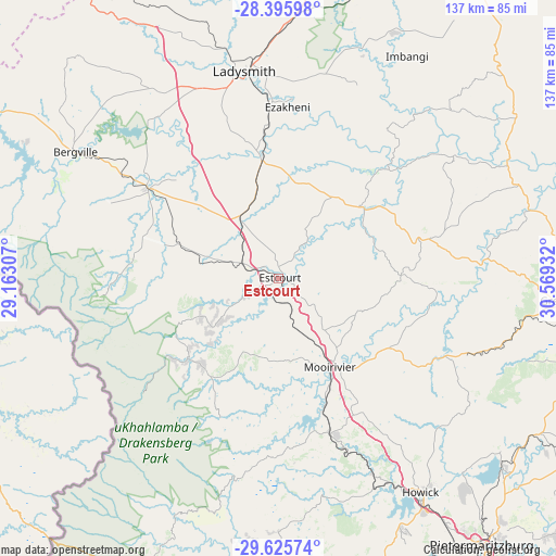
Estcourt GPS coordinates[2]
29° 0' 45.684" South, 29° 51' 58.284" East
| Map corner | latitude | longitude |
|---|---|---|
| Upper-left | -28.39598°, | 29.16307° |
| Center: | -29.01269°, | 29.86619° |
| Lower-right: | -29.62574°, | 30.56932° |
| Map W x H: | 136.7×136.7 km | = 84.9×84.9mi |
| max Lat: | -22.34881° ⇑55.2% North |
| Estcourt: | -29.01269° |
| min Lat: | ⇓44.8% South -34.66739° |
| min Long | Estcourt | max Long |
| 16.8697° | 29.86619° | 32.26762° |
| W 77.9%⇐ | ⇒22.1% E |
Elevation
Elevation of Estcourt is 1214 m = 3983 ft, and this is 244.4 m = 802 ft above average elevation for this country.
| Max E: |
1873 m = 6145 ft | 42.8% |
| Estcourt | 1214 m 3983 ft | |
| Avg. | 969.6 m = 3181 ft | |
Min E: |
7 m = 23 ft | 57.2% |
See also: South Africa elevation on elevation.city.
Geographical zone
Estcourt is located in South temperate zone (between Tropic of Capricorn and the Antarctic Circle). Distance of this Southern Tropic circle is 620 km =385.3 mi to North.| Distance of | km | miles | from Estcourt |
|---|---|---|---|
| Equator | 3225.9 | 2004.5 | to North |
| Tropic Capricorn | 620 | 385.3 | to North |
| Antarctic Circle | 4175.3 | 2594.4 | to South |
| South Pole | 6781.2 | 4213.6 | to South |


Nearby cities:
15 places around Estcourt: (largest is in red/bold)
• Bergville
59.1 km =36.7 mi,  302°
302°
• Camperdown
103.1 km =64.1 mi,  140°
140°
• Dundee
100.7 km =62.6 mi,  20°
20°
• Ekuvukeni
66.8 km =41.5 mi, 24°
• Glencoe
96.7 km =60.1 mi, 16°
• Greytown
70.9 km =44.1 mi,  94°
94°
• Himeville
88.5 km =55 mi,  202°
202°
• Howick
62.7 km =39 mi,  145°
145°
• Impendle
65.4 km =40.6 mi,  180°
180°
• Ladysmith
51.2 km =31.8 mi,  350°
350°
• Mooirivier
25.1 km =15.6 mi, 150°
• Mpophomeni
69.1 km =42.9 mi, 153°
• Pietermaritzburg
84.4 km =52.4 mi, 142°
• Tugela Ferry
64.2 km =39.9 mi,  62°
62°
• Wartburg
83.1 km =51.6 mi,  124°
124°
Sources, notices
• [Note1] Compared only with cities in South Africa existing in our database
• [Src1] Map data: © OpenStreetMap contributors (CC-BY-SA)
• [Src2] Other city data from geonames.org with taken over terms of usage.
• [Src3] Geographical zone / Annual Mean Temperature by Robert A. Rohde @ Wikipedia
