Ekuvukeni geodata
Ekuvukeni (KwaZulu-Natal) is a populated place; located in South Africa in Africa/Johannesburg (GMT+2) time zone. With population of 14,331 people, there are 174 cities with bigger population in this country. Compared to other cities in South Africa, 51.3% of cities are located further ↓South; 82.9% of cities are located further ←West and 56.3% of cities have higher elevation than Ekuvukeni. Note1
Administrative division(s):
- Level 1: KwaZulu-Natal
- Level 2: uThukela District Municipality
- Level 3: Indaka


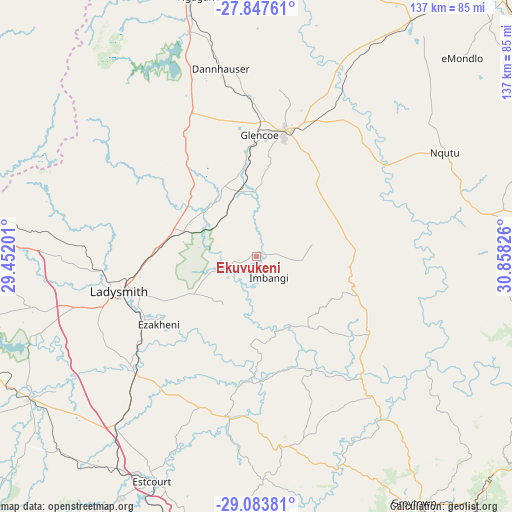
Ekuvukeni GPS coordinates[2]
28° 28' 3.072" South, 30° 9' 18.468" East
| Map corner | latitude | longitude |
|---|---|---|
| Upper-left | -27.84761°, | 29.45201° |
| Center: | -28.46752°, | 30.15513° |
| Lower-right: | -29.08381°, | 30.85826° |
| Map W x H: | 137.5×137.5 km | = 85.4×85.4mi |
| max Lat: | -22.34881° ⇑48.7% North |
| Ekuvukeni: | -28.46752° |
| min Lat: | ⇓51.3% South -34.66739° |
| min Long | Ekuvukeni | max Long |
| 16.8697° | 30.15513° | 32.26762° |
| W 82.9%⇐ | ⇒17.1% E |
Elevation
Elevation of Ekuvukeni is 1006 m = 3301 ft, and this is 36.4 m = 119 ft above average elevation for this country.
| Max E: |
1873 m = 6145 ft | 56.3% |
| Ekuvukeni | 1006 m 3301 ft | |
| Avg. | 969.6 m = 3181 ft | |
Min E: |
7 m = 23 ft | 43.7% |
See also: South Africa elevation on elevation.city.
Geographical zone
Ekuvukeni is located in South temperate zone (between Tropic of Capricorn and the Antarctic Circle). Distance of this Southern Tropic circle is 559.4 km =347.6 mi to North.| Distance of | km | miles | from Ekuvukeni |
|---|---|---|---|
| Equator | 3165.3 | 1966.8 | to North |
| Tropic Capricorn | 559.4 | 347.6 | to North |
| Antarctic Circle | 4235.9 | 2632.1 | to South |
| South Pole | 6841.8 | 4251.3 | to South |


Nearby cities:
15 places around Ekuvukeni: (largest is in red/bold)
• Bergville
83.7 km =52 mi,  249°
249°
• Dannhauser
51.2 km =31.8 mi,  349°
349°
• Dundee
34.3 km =21.3 mi,  12°
12°
• Estcourt
66.8 km =41.5 mi,  204°
204°
• Glencoe
32.2 km =20 mi,  358°
358°
• Greytown
78.9 km =49 mi,  147°
147°
• Harrismith
102.7 km =63.8 mi,  282°
282°
• Ladysmith
38.1 km =23.7 mi, 254°
• Mondlo
77.1 km =47.9 mi,  45°
45°
• Mooirivier
83.8 km =52.1 mi,  190°
190°
• Newcastle
81.9 km =50.9 mi,  344°
344°
• Nkandla
93 km =57.8 mi,  100°
100°
• Tugela Ferry
42.4 km =26.3 mi,  137°
137°
• Utrecht
91.4 km =56.8 mi, 10°
• Vryheid
99.6 km =61.9 mi,  38°
38°
Sources, notices
• [Note1] Compared only with cities in South Africa existing in our database
• [Src1] Map data: © OpenStreetMap contributors (CC-BY-SA)
• [Src2] Other city data from geonames.org with taken over terms of usage.
• [Src3] Geographical zone / Annual Mean Temperature by Robert A. Rohde @ Wikipedia
