Tugela Ferry geodata
Tugela Ferry (KwaZulu-Natal) is a seat of a third-order administrative division; located in South Africa in Africa/Johannesburg (GMT+2) time zone. In our database, there are 257 cities with bigger population. Compared to other cities in South Africa, 52.5% of cities are located further ↑North; 87% of cities are located further ←West and 72.6% of cities have higher elevation than Tugela Ferry. Note1
Administrative division(s):
- Level 1: KwaZulu-Natal
- Level 2: uMzinyathi District Municipality
- Level 3: Msinga


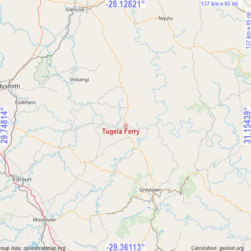
Tugela Ferry GPS coordinates[2]
28° 44' 47.364" South, 30° 27' 4.536" East
| Map corner | latitude | longitude |
|---|---|---|
| Upper-left | -28.12821°, | 29.74814° |
| Center: | -28.74649°, | 30.45126° |
| Lower-right: | -29.36113°, | 31.15439° |
| Map W x H: | 137.1×137.1 km | = 85.2×85.2mi |
| max Lat: | -22.34881° ⇑52.5% North |
| Tugela Ferry: | -28.74649° |
| min Lat: | ⇓47.5% South -34.66739° |
| min Long | Tugela Ferry | max Long |
| 16.8697° | 30.45126° | 32.26762° |
| W 87%⇐ | ⇒13% E |
Elevation
Elevation of Tugela Ferry is 559 m = 1834 ft, and this is 410.6 m = 1347 ft below average elevation for this country.
| Max E: |
1873 m = 6145 ft | 72.6% |
| Avg. | 969.6 m = 3181 ft | |
| Tugela Ferry | 559 m = 1834 ft | |
Min E: |
7 m = 23 ft | 27.4% |
See also: South Africa elevation on elevation.city.
Geographical zone
Tugela Ferry is located in South temperate zone (between Tropic of Capricorn and the Antarctic Circle). Distance of this Southern Tropic circle is 590.4 km =366.9 mi to North.| Distance of | km | miles | from Tugela Ferry |
|---|---|---|---|
| Equator | 3196.3 | 1986.1 | to North |
| Tropic Capricorn | 590.4 | 366.9 | to North |
| Antarctic Circle | 4204.9 | 2612.8 | to South |
| South Pole | 6810.8 | 4232 | to South |


Nearby cities:
15 places around Tugela Ferry: (largest is in red/bold)
• Dannhauser
90 km =55.9 mi,  334°
334°
• Dundee
67.9 km =42.2 mi,  341°
341°
• Ekuvukeni
42.4 km =26.3 mi,  317°
317°
• Estcourt
64.2 km =39.9 mi,  242°
242°
• Glencoe
69.8 km =43.4 mi, 334°
• Greytown
37.9 km =23.5 mi,  158°
158°
• Howick
84.1 km =52.3 mi,  194°
194°
• Ladysmith
68.8 km =42.8 mi,  287°
287°
• Melmoth
94 km =58.4 mi,  79°
79°
• Mondlo
88.8 km =55.2 mi,  17°
17°
• Mooirivier
67.9 km =42.2 mi,  220°
220°
• Mpophomeni
94.9 km =59 mi,  195°
195°
• Nkandla
63.9 km =39.7 mi, 77°
• Pietermaritzburg
96.9 km =60.2 mi,  183°
183°
• Wartburg
77.2 km =48 mi,  170°
170°
Sources, notices
• [Note1] Compared only with cities in South Africa existing in our database
• [Src1] Map data: © OpenStreetMap contributors (CC-BY-SA)
• [Src2] Other city data from geonames.org with taken over terms of usage.
• [Src3] Geographical zone / Annual Mean Temperature by Robert A. Rohde @ Wikipedia
