Ladysmith geodata
Ladysmith (KwaZulu-Natal) is a seat of a second-order administrative division; located in South Africa in Africa/Johannesburg (GMT+2) time zone. In our database, there are 257 cities with bigger population. Compared to other cities in South Africa, 50.1% of cities are located further ↑North; 76.4% of cities are located further ←West and 55.8% of cities have higher elevation than Ladysmith. Note1
Administrative division(s):
- Level 1: KwaZulu-Natal
- Level 2: uThukela District Municipality
- Level 3: Emnambithi/Ladysmith


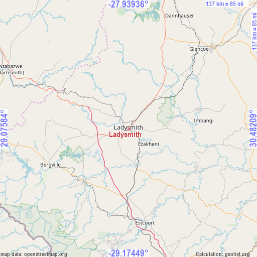
Ladysmith GPS coordinates[2]
28° 33' 31.464" South, 29° 46' 44.256" East
| Map corner | latitude | longitude |
|---|---|---|
| Upper-left | -27.93936°, | 29.07584° |
| Center: | -28.55874°, | 29.77896° |
| Lower-right: | -29.17449°, | 30.48209° |
| Map W x H: | 137.3×137.3 km | = 85.3×85.3mi |
| max Lat: | -22.34881° ⇑50.1% North |
| Ladysmith: | -28.55874° |
| min Lat: | ⇓49.9% South -34.66739° |
| min Long | Ladysmith | max Long |
| 16.8697° | 29.77896° | 32.26762° |
| W 76.4%⇐ | ⇒23.6% E |
Elevation
Elevation of Ladysmith is 1010 m = 3314 ft, and this is 40.4 m = 133 ft above average elevation for this country.
| Max E: |
1873 m = 6145 ft | 55.8% |
| Ladysmith | 1010 m 3314 ft | |
| Avg. | 969.6 m = 3181 ft | |
Min E: |
7 m = 23 ft | 44.2% |
See also: South Africa elevation on elevation.city.
Geographical zone
Ladysmith is located in South temperate zone (between Tropic of Capricorn and the Antarctic Circle). Distance of this Southern Tropic circle is 569.5 km =353.9 mi to North.| Distance of | km | miles | from Ladysmith |
|---|---|---|---|
| Equator | 3175.4 | 1973.1 | to North |
| Tropic Capricorn | 569.5 | 353.9 | to North |
| Antarctic Circle | 4225.7 | 2625.7 | to South |
| South Pole | 6831.6 | 4245 | to South |


Nearby cities:
15 places around Ladysmith: (largest is in red/bold)
• Bergville
45.9 km =28.5 mi,  245°
245°
• Dannhauser
66.3 km =41.2 mi,  24°
24°
• Dundee
62.3 km =38.7 mi,  45°
45°
• Ekuvukeni
38.1 km =23.7 mi,  74°
74°
• Estcourt
51.2 km =31.8 mi,  170°
170°
• Glencoe
55.6 km =34.5 mi,  40°
40°
• Greytown
97.2 km =60.4 mi,  125°
125°
• Harrismith
71 km =44.1 mi,  296°
296°
• Howick
111.2 km =69.1 mi,  156°
156°
• Mondlo
112 km =69.6 mi,  55°
55°
• Mooirivier
75.2 km =46.7 mi, 163°
• Newcastle
90.3 km =56.1 mi,  9°
9°
• Phuthaditjhaba
94.2 km =58.5 mi,  272°
272°
• Tugela Ferry
68.8 km =42.8 mi,  107°
107°
• Utrecht
113.4 km =70.5 mi,  28°
28°
Sources, notices
• [Note1] Compared only with cities in South Africa existing in our database
• [Src1] Map data: © OpenStreetMap contributors (CC-BY-SA)
• [Src2] Other city data from geonames.org with taken over terms of usage.
• [Src3] Geographical zone / Annual Mean Temperature by Robert A. Rohde @ Wikipedia
