Bethlehem geodata
Bethlehem (Orange Free State) is a seat of a third-order administrative division; located in South Africa in Africa/Johannesburg (GMT+2) time zone. With population of 83,654 people, there are 65 cities with bigger population in this country. Compared to other cities in South Africa, 54% of cities are located further ↓South; 62.5% of cities are located further ←West and 92.3% of cities have lower elevation than Bethlehem. Note1
Administrative division(s):
- Level 1: Orange Free State
- Level 2: Thabo Mofutsanyana District Municipality
- Level 3: Dihlabeng


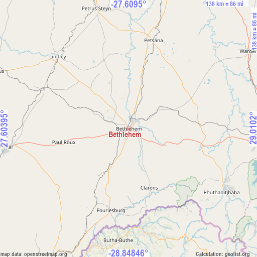
Bethlehem GPS coordinates[2]
28° 13' 50.808" South, 28° 18' 25.452" East
| Map corner | latitude | longitude |
|---|---|---|
| Upper-left | -27.6095°, | 27.60395° |
| Center: | -28.23078°, | 28.30707° |
| Lower-right: | -28.84846°, | 29.0102° |
| Map W x H: | 137.8×137.8 km | = 85.6×85.6mi |
| max Lat: | -22.34881° ⇑46% North |
| Bethlehem: | -28.23078° |
| min Lat: | ⇓54% South -34.66739° |
| min Long | Bethlehem | max Long |
| 16.8697° | 28.30707° | 32.26762° |
| W 62.5%⇐ | ⇒37.5% E |
Elevation
Elevation of Bethlehem is 1630 m = 5348 ft, and this is 660.4 m = 2167 ft above average elevation for this country.
| Max E: |
1873 m = 6145 ft | 7.7% |
| Bethlehem | 1630 m 5348 ft | |
| Avg. | 969.6 m = 3181 ft | |
Min E: |
7 m = 23 ft | 92.3% |
See also: Bethlehem elevation on elevation.city.
Geographical zone
Bethlehem is located in South temperate zone (between Tropic of Capricorn and the Antarctic Circle). Distance of this Southern Tropic circle is 533 km =331.2 mi to North.| Distance of | km | miles | from Bethlehem |
|---|---|---|---|
| Equator | 3139 | 1950.5 | to North |
| Tropic Capricorn | 533 | 331.2 | to North |
| Antarctic Circle | 4262.2 | 2648.4 | to South |
| South Pole | 6868.1 | 4267.6 | to South |


Nearby cities:
15 places around Bethlehem: (largest is in red/bold)
• Bergville
116.3 km =72.3 mi,  118°
118°
• Clocolan
104.9 km =65.2 mi,  223°
223°
• Ficksburg
82.8 km =51.4 mi,  210°
210°
• Frankfort
107.5 km =66.8 mi,  10°
10°
• Harrismith
80.7 km =50.1 mi,  93°
93°
• Heilbron
110.6 km =68.7 mi,  342°
342°
• Hennenman
129 km =80.2 mi,  282°
282°
• Kroonstad
123.5 km =76.7 mi,  301°
301°
• Lindley
55 km =34.2 mi,  315°
315°
• Marquard
98.3 km =61.1 mi,  240°
240°
• Phuthaditjhaba
59.5 km =37 mi, 123°
• Reitz
49.2 km =30.6 mi, 13°
• Senekal
67.9 km =42.2 mi,  261°
261°
• Ventersburg
115.7 km =71.9 mi, 278°
• Vrede
123.1 km =76.5 mi,  43°
43°
Sources, notices
• [Note1] Compared only with cities in South Africa existing in our database
• [Src1] Map data: © OpenStreetMap contributors (CC-BY-SA)
• [Src2] Other city data from geonames.org with taken over terms of usage.
• [Src3] Geographical zone / Annual Mean Temperature by Robert A. Rohde @ Wikipedia
