Frankfort geodata
Frankfort (Orange Free State) is a seat of a third-order administrative division; located in South Africa in Africa/Johannesburg (GMT+2) time zone. With population of 1,900 people, there are 250 cities with bigger population in this country. Compared to other cities in South Africa, 65.8% of cities are located further ↓South; 65.2% of cities are located further ←West and 84.7% of cities have lower elevation than Frankfort. Note1
Administrative division(s):
- Level 1: Orange Free State
- Level 2: Fezile Dabi District Municipality
- Level 3: Mafube


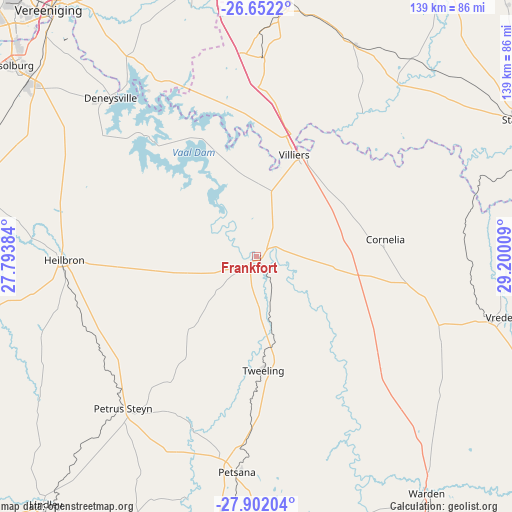
Frankfort GPS coordinates[2]
27° 16' 43.968" South, 28° 29' 49.056" East
| Map corner | latitude | longitude |
|---|---|---|
| Upper-left | -26.6522°, | 27.79384° |
| Center: | -27.27888°, | 28.49696° |
| Lower-right: | -27.90204°, | 29.20009° |
| Map W x H: | 139×139 km | = 86.4×86.4mi |
| max Lat: | -22.34881° ⇑34.2% North |
| Frankfort: | -27.27888° |
| min Lat: | ⇓65.8% South -34.66739° |
| min Long | Frankfort | max Long |
| 16.8697° | 28.49696° | 32.26762° |
| W 65.2%⇐ | ⇒34.8% E |
Elevation
Elevation of Frankfort is 1545 m = 5069 ft, and this is 575.4 m = 1888 ft above average elevation for this country.
| Max E: |
1873 m = 6145 ft | 15.3% |
| Frankfort | 1545 m 5069 ft | |
| Avg. | 969.6 m = 3181 ft | |
Min E: |
7 m = 23 ft | 84.7% |
See also: South Africa elevation on elevation.city.
Geographical zone
Frankfort is located in South temperate zone (between Tropic of Capricorn and the Antarctic Circle). Distance of this Southern Tropic circle is 427.2 km =265.4 mi to North.| Distance of | km | miles | from Frankfort |
|---|---|---|---|
| Equator | 3033.1 | 1884.7 | to North |
| Tropic Capricorn | 427.2 | 265.4 | to North |
| Antarctic Circle | 4368 | 2714.1 | to South |
| South Pole | 6973.9 | 4333.4 | to South |


Nearby cities:
15 places around Frankfort: (largest is in red/bold)
• Balfour
69.1 km =42.9 mi,  7°
7°
• Deneysville
58.6 km =36.4 mi,  317°
317°
• Heidelberg
87.2 km =54.2 mi,  350°
350°
• Heilbron
52 km =32.3 mi,  269°
269°
• Koppies
91.3 km =56.7 mi, 272°
• Lindley
88.1 km =54.7 mi,  220°
220°
• Meyerton
92.9 km =57.7 mi,  329°
329°
• Nigel
94.3 km =58.6 mi,  358°
358°
• Reitz
58.5 km =36.4 mi,  186°
186°
• Sasolburg
84.9 km =52.8 mi,  307°
307°
• Standerton
83.1 km =51.6 mi,  62°
62°
• Vanderbijlpark
90.8 km =56.4 mi, 314°
• Vereeniging
88 km =54.7 mi, 319°
• Villiers
29.5 km =18.3 mi,  20°
20°
• Vrede
68 km =42.3 mi,  103°
103°
Sources, notices
• [Note1] Compared only with cities in South Africa existing in our database
• [Src1] Map data: © OpenStreetMap contributors (CC-BY-SA)
• [Src2] Other city data from geonames.org with taken over terms of usage.
• [Src3] Geographical zone / Annual Mean Temperature by Robert A. Rohde @ Wikipedia
