Mīray geodata
Mīray (Ghazni) is a seat of a second-order administrative division; located in Afghanistan in Asia/Kabul (GMT+4.5) time zone. In our database, there are 93 cities with bigger population. Compared to other cities in Afghanistan, 76.8% of cities are located further ↑North; 50.8% of cities are located further →East and 76.5% of cities have lower elevation than Mīray. Note1


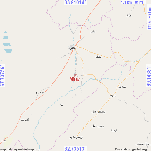
Mīray GPS coordinates[2]
33° 19' 28.632" North, 68° 26' 26.448" East
| Map corner | latitude | longitude |
|---|---|---|
| Upper-left | 33.91014°, | 67.73756° |
| Center: | 33.32462°, | 68.44068° |
| Lower-right: | 32.73513°, | 69.14381° |
| Map W x H: | 130.6×130.6 km | = 81.2×81.2mi |
| max Lat: | 38.4435° ⇑76.8% North |
| Mīray: | 33.32462° |
| min Lat: | ⇓23.2% South 30.15° |
| min Long | Mīray | max Long |
| 61.06667° | 68.44068° | 72.318° |
| W 49.2%⇐ | ⇒50.8% E |
Elevation
Elevation of Mīray is 2077 m = 6814 ft, and this is 658.6 m = 2161 ft above average elevation for this country.
| Max E: |
3068 m = 10066 ft | 23.5% |
| Mīray | 2077 m 6814 ft | |
| Avg. | 1418.4 m = 4654 ft | |
Min E: |
254 m = 833 ft | 76.5% |
See also: Afghanistan elevation on elevation.city.
Geographical zone
Mīray is located in North temperate zone (between Tropic of Cancer and the Arctic Circle). Distance of this Northern Tropic circle is 1099.4 km =683.1 mi to South.| Distance of | km | miles | from Mīray |
|---|---|---|---|
| North Pole | 6301.7 | 3915.7 | to North |
| Arctic Circle | 3695.8 | 2296.5 | to North |
| Tropic Cancer | 1099.4 | 683.1 | to South |
| Equator | 3705.4 | 2302.4 | to South |


Nearby cities:
15 places around Mīray: (largest is in red/bold)
• Chahār Qal‘ah
28.6 km =17.8 mi,  332°
332°
• Ghazni
25.6 km =15.9 mi,  355°
355°
• Kalān Deh
57.1 km =35.5 mi, 356°
• Khayr Kōṯ
52.4 km =32.6 mi,  179°
179°
• Mutā Khān
40.7 km =25.3 mi,  103°
103°
• Qarah Bāgh
34 km =21.1 mi,  245°
245°
• Rāmak
27.9 km =17.3 mi,  38°
38°
• Sharan
31.6 km =19.6 mi,  121°
121°
• Tōrmay
40.6 km =25.2 mi,  354°
354°
• Yaḩyá Khēl
47.1 km =29.3 mi,  156°
156°
• Zarghūn Shahr
53.1 km =33 mi, 179°
• Zaṟah Sharan
38.2 km =23.7 mi, 121°
• Zurmat
55.9 km =34.7 mi,  77°
77°
• Ōmnah
57.6 km =35.8 mi,  144°
144°
• ‘Alāqahdārī Yōsuf Khēl
36 km =22.4 mi,  147°
147°
Sources, notices
• [Note1] Compared only with cities in Afghanistan existing in our database
• [Src1] Map data: © OpenStreetMap contributors (CC-BY-SA)
• [Src2] Other city data from geonames.org with taken over terms of usage.
• [Src3] Geographical zone / Annual Mean Temperature by Robert A. Rohde @ Wikipedia
