Kalān Deh geodata
Kalān Deh (Vardak) is a seat of a second-order administrative division; located in Afghanistan in Asia/Kabul (GMT+4.5) time zone. In our database, there are 93 cities with bigger population. Compared to other cities in Afghanistan, 68.5% of cities are located further ↑North; 51.4% of cities are located further →East and 94.5% of cities have lower elevation than Kalān Deh. Note1


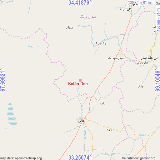
Kalān Deh GPS coordinates[2]
33° 50' 12.336" North, 68° 24' 8.388" East
| Map corner | latitude | longitude |
|---|---|---|
| Upper-left | 34.41879°, | 67.69921° |
| Center: | 33.83676°, | 68.40233° |
| Lower-right: | 33.25074°, | 69.10546° |
| Map W x H: | 129.9×129.9 km | = 80.7×80.7mi |
| max Lat: | 38.4435° ⇑68.5% North |
| Kalān Deh: | 33.83676° |
| min Lat: | ⇓31.5% South 30.15° |
| min Long | Kalān Deh | max Long |
| 61.06667° | 68.40233° | 72.318° |
| W 48.6%⇐ | ⇒51.4% E |
Elevation
Elevation of Kalān Deh is 2502 m = 8209 ft, and this is 1083.6 m = 3555 ft above average elevation for this country.
| Max E: |
3068 m = 10066 ft | 5.5% |
| Kalān Deh | 2502 m 8209 ft | |
| Avg. | 1418.4 m = 4654 ft | |
Min E: |
254 m = 833 ft | 94.5% |
See also: Afghanistan elevation on elevation.city.
Geographical zone
Kalān Deh is located in North temperate zone (between Tropic of Cancer and the Arctic Circle). Distance of this Northern Tropic circle is 1156.4 km =718.6 mi to South.| Distance of | km | miles | from Kalān Deh |
|---|---|---|---|
| North Pole | 6244.8 | 3880.3 | to North |
| Arctic Circle | 3638.9 | 2261.1 | to North |
| Tropic Cancer | 1156.4 | 718.6 | to South |
| Equator | 3762.3 | 2337.8 | to South |


Nearby cities:
15 places around Kalān Deh: (largest is in red/bold)
• Baraki Barak
52.5 km =32.6 mi,  73°
73°
• Chahār Qal‘ah
33 km =20.5 mi,  196°
196°
• Charkh
49.6 km =30.8 mi,  95°
95°
• Ghazni
31.5 km =19.6 mi,  176°
176°
• Jalrēz
74.2 km =46.1 mi,  18°
18°
• Markaz-e Sayyidābād
34 km =21.1 mi,  57°
57°
• Maydanshakhr
75.4 km =46.9 mi,  34°
34°
• Mīray
57.1 km =35.5 mi, 176°
• Mīrān
43.4 km =27 mi,  349°
349°
• Pul-e ‘Alam
59.9 km =37.2 mi, 72°
• Rāmak
40.6 km =25.2 mi,  149°
149°
• Tōrmay
16.5 km =10.3 mi, 180°
• Wulêswālī Bihsūd
72.6 km =45.1 mi,  320°
320°
• Zurmat
72.9 km =45.3 mi,  127°
127°
• Ōkak
41.7 km =25.9 mi,  279°
279°
Sources, notices
• [Note1] Compared only with cities in Afghanistan existing in our database
• [Src1] Map data: © OpenStreetMap contributors (CC-BY-SA)
• [Src2] Other city data from geonames.org with taken over terms of usage.
• [Src3] Geographical zone / Annual Mean Temperature by Robert A. Rohde @ Wikipedia
