Zurmat geodata
Zurmat (Paktia) is a seat of a second-order administrative division; located in Afghanistan in Asia/Kabul (GMT+4.5) time zone. In our database, there are 93 cities with bigger population. Compared to other cities in Afghanistan, 75.2% of cities are located further ↑North; 59.5% of cities are located further ←West and 82% of cities have lower elevation than Zurmat. Note1


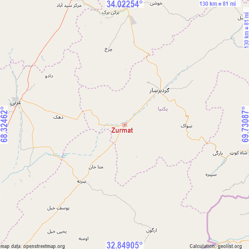
Zurmat GPS coordinates[2]
33° 26' 16.008" North, 69° 1' 39.864" East
| Map corner | latitude | longitude |
|---|---|---|
| Upper-left | 34.02254°, | 68.32462° |
| Center: | 33.43778°, | 69.02774° |
| Lower-right: | 32.84905°, | 69.73087° |
| Map W x H: | 130.5×130.5 km | = 81.1×81.1mi |
| max Lat: | 38.4435° ⇑75.2% North |
| Zurmat: | 33.43778° |
| min Lat: | ⇓24.8% South 30.15° |
| min Long | Zurmat | max Long |
| 61.06667° | 69.02774° | 72.318° |
| W 59.5%⇐ | ⇒40.5% E |
Elevation
Elevation of Zurmat is 2150 m = 7054 ft, and this is 731.6 m = 2400 ft above average elevation for this country.
| Max E: |
3068 m = 10066 ft | 18% |
| Zurmat | 2150 m 7054 ft | |
| Avg. | 1418.4 m = 4654 ft | |
Min E: |
254 m = 833 ft | 82% |
See also: Afghanistan elevation on elevation.city.
Geographical zone
Zurmat is located in North temperate zone (between Tropic of Cancer and the Arctic Circle). Distance of this Northern Tropic circle is 1112 km =691 mi to South.| Distance of | km | miles | from Zurmat |
|---|---|---|---|
| North Pole | 6289.1 | 3907.9 | to North |
| Arctic Circle | 3683.2 | 2288.6 | to North |
| Tropic Cancer | 1112 | 691 | to South |
| Equator | 3717.9 | 2310.2 | to South |


Nearby cities:
15 places around Zurmat: (largest is in red/bold)
• Charkh
40.8 km =25.4 mi,  348°
348°
• Dwah Manḏay
54.6 km =33.9 mi,  108°
108°
• Gardez
25.5 km =15.8 mi,  45°
45°
• Mutā Khān
26.6 km =16.5 mi,  214°
214°
• Mīray
55.9 km =34.7 mi,  257°
257°
• Nīkêh
35.7 km =22.2 mi,  140°
140°
• Rāmak
38.4 km =23.9 mi,  284°
284°
• Salām Khēl
38.1 km =23.7 mi, 47°
• Sharan
40.2 km =25 mi,  223°
223°
• Shwāk
32.4 km =20.1 mi,  92°
92°
• Spērah
52.3 km =32.5 mi,  120°
120°
• Wulêswālī Sayyid Karam
42.3 km =26.3 mi, 48°
• Zaṟah Sharan
39.1 km =24.3 mi, 214°
• Zerok-Alakadari
40.9 km =25.4 mi, 139°
• ‘Alāqahdārī Yōsuf Khēl
55.4 km =34.4 mi, 219°
Sources, notices
• [Note1] Compared only with cities in Afghanistan existing in our database
• [Src1] Map data: © OpenStreetMap contributors (CC-BY-SA)
• [Src2] Other city data from geonames.org with taken over terms of usage.
• [Src3] Geographical zone / Annual Mean Temperature by Robert A. Rohde @ Wikipedia
