Chahār Qal‘ah geodata
Chahār Qal‘ah (Ghazni) is a seat of a second-order administrative division; located in Afghanistan in Asia/Kabul (GMT+4.5) time zone. In our database, there are 93 cities with bigger population. Compared to other cities in Afghanistan, 73.3% of cities are located further ↑North; 52.7% of cities are located further →East and 90.4% of cities have lower elevation than Chahār Qal‘ah. Note1


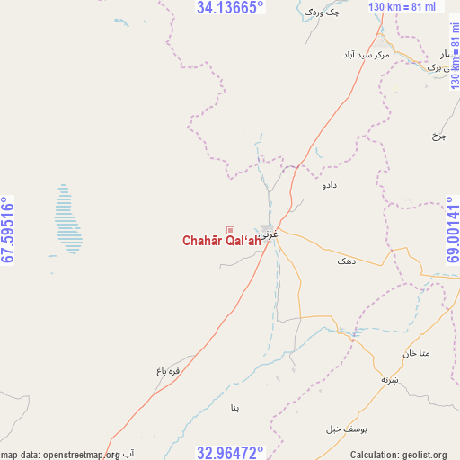
Chahār Qal‘ah GPS coordinates[2]
33° 33' 9.612" North, 68° 17' 53.808" East
| Map corner | latitude | longitude |
|---|---|---|
| Upper-left | 34.13665°, | 67.59516° |
| Center: | 33.55267°, | 68.29828° |
| Lower-right: | 32.96472°, | 69.00141° |
| Map W x H: | 130.3×130.3 km | = 81×81mi |
| max Lat: | 38.4435° ⇑73.3% North |
| Chahār Qal‘ah: | 33.55267° |
| min Lat: | ⇓26.7% South 30.15° |
| min Long | Chahār Qal‘a | max Long |
| 61.06667° | 68.29828° | 72.318° |
| W 47.3%⇐ | ⇒52.7% E |
Elevation
Elevation of Chahār Qal‘ah is 2376 m = 7795 ft, and this is 957.6 m = 3142 ft above average elevation for this country.
| Max E: |
3068 m = 10066 ft | 9.6% |
| Chahār Qal‘ah | 2376 m 7795 ft | |
| Avg. | 1418.4 m = 4654 ft | |
Min E: |
254 m = 833 ft | 90.4% |
See also: Afghanistan elevation on elevation.city.
Geographical zone
Chahār Qal‘ah is located in North temperate zone (between Tropic of Cancer and the Arctic Circle). Distance of this Northern Tropic circle is 1124.8 km =698.9 mi to South.| Distance of | km | miles | from Chahār Qal‘ah |
|---|---|---|---|
| North Pole | 6276.4 | 3900 | to North |
| Arctic Circle | 3670.5 | 2280.7 | to North |
| Tropic Cancer | 1124.8 | 698.9 | to South |
| Equator | 3730.7 | 2318.1 | to South |


Nearby cities:
15 places around Chahār Qal‘ah: (largest is in red/bold)
• Charkh
65.1 km =40.5 mi,  65°
65°
• Ghazni
11.4 km =7.1 mi,  89°
89°
• Kalān Deh
33 km =20.5 mi,  16°
16°
• Markaz-e Sayyidābād
62.9 km =39.1 mi,  37°
37°
• Mutā Khān
63.2 km =39.3 mi,  123°
123°
• Mīray
28.6 km =17.8 mi,  152°
152°
• Qarah Bāgh
43.2 km =26.8 mi,  204°
204°
• Rāmak
30.6 km =19 mi,  96°
96°
• Sarfirāz Kalā
70.5 km =43.8 mi,  206°
206°
• Sharan
58 km =36 mi,  136°
136°
• Tōrmay
17.9 km =11.1 mi,  32°
32°
• Zaṟah Sharan
64.4 km =40 mi,  134°
134°
• Zurmat
68.8 km =42.8 mi, 100°
• Ōkak
49.7 km =30.9 mi,  320°
320°
• ‘Alāqahdārī Yōsuf Khēl
64.6 km =40.1 mi, 149°
Sources, notices
• [Note1] Compared only with cities in Afghanistan existing in our database
• [Src1] Map data: © OpenStreetMap contributors (CC-BY-SA)
• [Src2] Other city data from geonames.org with taken over terms of usage.
• [Src3] Geographical zone / Annual Mean Temperature by Robert A. Rohde @ Wikipedia
