Sarfirāz Kalā geodata
Sarfirāz Kalā (Ghazni) is a seat of a second-order administrative division; located in Afghanistan in Asia/Kabul (GMT+4.5) time zone. In our database, there are 93 cities with bigger population. Compared to other cities in Afghanistan, 82% of cities are located further ↑North; 55% of cities are located further →East and 78.1% of cities have lower elevation than Sarfirāz Kalā. Note1


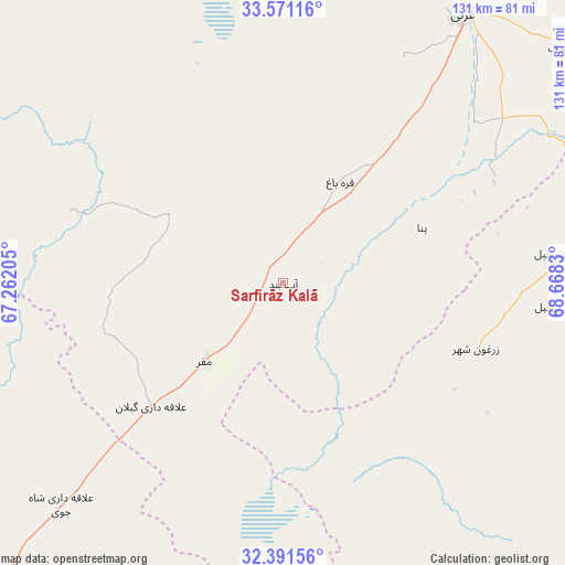
Sarfirāz Kalā GPS coordinates[2]
32° 58' 59.988" North, 67° 57' 54.612" East
| Map corner | latitude | longitude |
|---|---|---|
| Upper-left | 33.57116°, | 67.26205° |
| Center: | 32.98333°, | 67.96517° |
| Lower-right: | 32.39156°, | 68.6683° |
| Map W x H: | 131.2×131.2 km | = 81.5×81.5mi |
| max Lat: | 38.4435° ⇑82% North |
| Sarfirāz Kalā: | 32.98333° |
| min Lat: | ⇓18% South 30.15° |
| min Long | Sarfirāz Kalā | max Long |
| 61.06667° | 67.96517° | 72.318° |
| W 45%⇐ | ⇒55% E |
Elevation
Elevation of Sarfirāz Kalā is 2106 m = 6909 ft, and this is 687.6 m = 2256 ft above average elevation for this country.
| Max E: |
3068 m = 10066 ft | 21.9% |
| Sarfirāz Kalā | 2106 m 6909 ft | |
| Avg. | 1418.4 m = 4654 ft | |
Min E: |
254 m = 833 ft | 78.1% |
See also: Afghanistan elevation on elevation.city.
Geographical zone
Sarfirāz Kalā is located in North temperate zone (between Tropic of Cancer and the Arctic Circle). Distance of this Northern Tropic circle is 1061.5 km =659.6 mi to South.| Distance of | km | miles | from Sarfirāz Kalā |
|---|---|---|---|
| North Pole | 6339.7 | 3939.3 | to North |
| Arctic Circle | 3733.8 | 2320.1 | to North |
| Tropic Cancer | 1061.5 | 659.6 | to South |
| Equator | 3667.4 | 2278.8 | to South |


Nearby cities:
15 places around Sarfirāz Kalā: (largest is in red/bold)
• Chahār Qal‘ah
70.5 km =43.8 mi,  26°
26°
• Ghazni
76.3 km =47.4 mi, 33°
• Jānī Khēl
47.2 km =29.3 mi,  121°
121°
• Khayr Kōṯ
47.5 km =29.5 mi,  107°
107°
• Khōshāmand
41.8 km =26 mi,  142°
142°
• Muqêr
25.8 km =16 mi,  225°
225°
• Mīray
58.3 km =36.2 mi,  49°
49°
• Qarah Bāgh
27.3 km =17 mi, 29°
• Sang-e Māshah
51.9 km =32.2 mi,  289°
289°
• Sharan
74.4 km =46.2 mi,  73°
73°
• Yaḩyá Khēl
63.7 km =39.6 mi,  94°
94°
• Zarghūn Shahr
47.3 km =29.4 mi, 108°
• ‘Alāqahdārī Gēlān
41.9 km =26 mi, 227°
• ‘Alāqahdārī Shāh Jōy
72.8 km =45.2 mi, 225°
• ‘Alāqahdārī Yōsuf Khēl
64.3 km =40 mi,  83°
83°
Sources, notices
• [Note1] Compared only with cities in Afghanistan existing in our database
• [Src1] Map data: © OpenStreetMap contributors (CC-BY-SA)
• [Src2] Other city data from geonames.org with taken over terms of usage.
• [Src3] Geographical zone / Annual Mean Temperature by Robert A. Rohde @ Wikipedia
