Muqêr geodata
Muqêr (Ghazni) is a seat of a second-order administrative division; located in Afghanistan in Asia/Kabul (GMT+4.5) time zone. In our database, there are 93 cities with bigger population. Compared to other cities in Afghanistan, 84.9% of cities are located further ↑North; 56.6% of cities are located further →East and 73.6% of cities have lower elevation than Muqêr. Note1


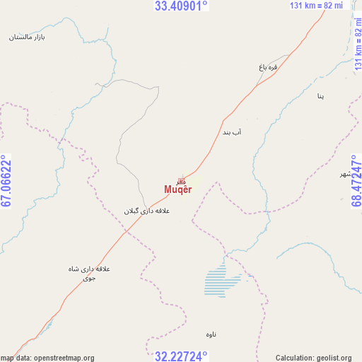
Muqêr GPS coordinates[2]
32° 49' 12.324" North, 67° 46' 9.624" East
| Map corner | latitude | longitude |
|---|---|---|
| Upper-left | 33.40901°, | 67.06622° |
| Center: | 32.82009°, | 67.76934° |
| Lower-right: | 32.22724°, | 68.47247° |
| Map W x H: | 131.4×131.4 km | = 81.6×81.6mi |
| max Lat: | 38.4435° ⇑84.9% North |
| Muqêr: | 32.82009° |
| min Lat: | ⇓15.1% South 30.15° |
| min Long | Muqêr | max Long |
| 61.06667° | 67.76934° | 72.318° |
| W 43.4%⇐ | ⇒56.6% E |
Elevation
Elevation of Muqêr is 2000 m = 6562 ft, and this is 581.6 m = 1908 ft above average elevation for this country.
| Max E: |
3068 m = 10066 ft | 26.4% |
| Muqêr | 2000 m 6562 ft | |
| Avg. | 1418.4 m = 4654 ft | |
Min E: |
254 m = 833 ft | 73.6% |
See also: Afghanistan elevation on elevation.city.
Geographical zone
Muqêr is located in North temperate zone (between Tropic of Cancer and the Arctic Circle). Distance of this Northern Tropic circle is 1043.3 km =648.3 mi to South.| Distance of | km | miles | from Muqêr |
|---|---|---|---|
| North Pole | 6357.8 | 3950.6 | to North |
| Arctic Circle | 3751.9 | 2331.3 | to North |
| Tropic Cancer | 1043.3 | 648.3 | to South |
| Equator | 3649.3 | 2267.6 | to South |


Nearby cities:
15 places around Muqêr: (largest is in red/bold)
• Chahār Qal‘ah
95.2 km =59.2 mi,  31°
31°
• Jānī Khēl
59 km =36.7 mi,  96°
96°
• Khayr Kōṯ
63.7 km =39.6 mi,  86°
86°
• Khākirān
65 km =40.4 mi,  271°
271°
• Khōshāmand
46.3 km =28.8 mi,  108°
108°
• Mīray
84 km =52.2 mi,  48°
48°
• Qarah Bāgh
52.6 km =32.7 mi,  36°
36°
• Sang-e Māshah
46.9 km =29.1 mi,  319°
319°
• Sarfirāz Kalā
25.8 km =16 mi, 45°
• Sāyagaz
74.5 km =46.3 mi,  247°
247°
• Yaḩyá Khēl
82.9 km =51.5 mi,  80°
80°
• Zarghūn Shahr
63.3 km =39.3 mi, 87°
• ‘Alāqahdārī Gēlān
16.1 km =10 mi,  230°
230°
• ‘Alāqahdārī Shāh Jōy
47 km =29.2 mi, 225°
• ‘Alāqahdārī Yōsuf Khēl
86.1 km =53.5 mi,  72°
72°
Sources, notices
• [Note1] Compared only with cities in Afghanistan existing in our database
• [Src1] Map data: © OpenStreetMap contributors (CC-BY-SA)
• [Src2] Other city data from geonames.org with taken over terms of usage.
• [Src3] Geographical zone / Annual Mean Temperature by Robert A. Rohde @ Wikipedia
