‘Alāqahdārī Gēlān geodata
‘Alāqahdārī Gēlān (Ghazni) is a seat of a second-order administrative division; located in Afghanistan in Asia/Kabul (GMT+4.5) time zone. In our database, there are 93 cities with bigger population. Compared to other cities in Afghanistan, 86.2% of cities are located further ↑North; 57.9% of cities are located further →East and 73% of cities have lower elevation than ‘Alāqahdārī Gēlān. Note1


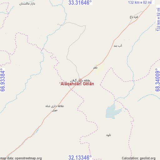
‘Alāqahdārī Gēlān GPS coordinates[2]
32° 43' 36.912" North, 67° 38' 13.056" East
| Map corner | latitude | longitude |
|---|---|---|
| Upper-left | 33.31646°, | 66.93384° |
| Center: | 32.72692°, | 67.63696° |
| Lower-right: | 32.13346°, | 68.34009° |
| Map W x H: | 131.5×131.5 km | = 81.7×81.7mi |
| max Lat: | 38.4435° ⇑86.2% North |
| ‘Alāqahdārī Gēlān: | 32.72692° |
| min Lat: | ⇓13.8% South 30.15° |
| min Long | ‘Alāqahdār� | max Long |
| 61.06667° | 67.63696° | 72.318° |
| W 42.1%⇐ | ⇒57.9% E |
Elevation
Elevation of ‘Alāqahdārī Gēlān is 1987 m = 6519 ft, and this is 568.6 m = 1865 ft above average elevation for this country.
| Max E: |
3068 m = 10066 ft | 27% |
| ‘Alāqahdārī Gēlān | 1987 m 6519 ft | |
| Avg. | 1418.4 m = 4654 ft | |
Min E: |
254 m = 833 ft | 73% |
See also: Afghanistan elevation on elevation.city.
Geographical zone
‘Alāqahdārī Gēlān is located in North temperate zone (between Tropic of Cancer and the Arctic Circle). Distance of this Northern Tropic circle is 1033 km =641.9 mi to South.| Distance of | km | miles | from ‘Alāqahdārī Gēlān |
|---|---|---|---|
| North Pole | 6368.2 | 3957 | to North |
| Arctic Circle | 3762.3 | 2337.8 | to North |
| Tropic Cancer | 1033 | 641.9 | to South |
| Equator | 3638.9 | 2261.1 | to South |


Nearby cities:
15 places around ‘Alāqahdārī Gēlān: (largest is in red/bold)
• Jānī Khēl
71.2 km =44.2 mi,  86°
86°
• Khayr Kōṯ
77.3 km =48 mi,  79°
79°
• Khākirān
54.1 km =33.6 mi,  283°
283°
• Khōshāmand
56.4 km =35 mi, 94°
• Muqêr
16.1 km =10 mi,  50°
50°
• Nāyak
82.6 km =51.3 mi,  257°
257°
• Qarah Bāgh
68.4 km =42.5 mi,  39°
39°
• Sang-e Māshah
49.4 km =30.7 mi,  338°
338°
• Sarfirāz Kalā
41.9 km =26 mi, 47°
• Sāyagaz
59.3 km =36.8 mi,  252°
252°
• Uruzgān
96.5 km =60 mi, 283°
• Yaḩyá Khēl
97.2 km =60.4 mi, 76°
• Zarghūn Shahr
76.8 km =47.7 mi, 79°
• Ḩukūmat-e Shīnkaī
87.4 km =54.3 mi,  198°
198°
• ‘Alāqahdārī Shāh Jōy
31 km =19.3 mi,  222°
222°
Sources, notices
• [Note1] Compared only with cities in Afghanistan existing in our database
• [Src1] Map data: © OpenStreetMap contributors (CC-BY-SA)
• [Src2] Other city data from geonames.org with taken over terms of usage.
• [Src3] Geographical zone / Annual Mean Temperature by Robert A. Rohde @ Wikipedia
