Khākirān geodata
Khākirān (Zabul) is a seat of a second-order administrative division; located in Afghanistan in Asia/Kabul (GMT+4.5) time zone. In our database, there are 93 cities with bigger population. Compared to other cities in Afghanistan, 84.6% of cities are located further ↑North; 60.5% of cities are located further →East and 97.4% of cities have lower elevation than Khākirān. Note1


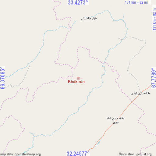
Khākirān GPS coordinates[2]
32° 50' 18.6" North, 67° 4' 25.572" East
| Map corner | latitude | longitude |
|---|---|---|
| Upper-left | 33.4273°, | 66.37065° |
| Center: | 32.8385°, | 67.07377° |
| Lower-right: | 32.24577°, | 67.7769° |
| Map W x H: | 131.4×131.4 km | = 81.6×81.6mi |
| max Lat: | 38.4435° ⇑84.6% North |
| Khākirān: | 32.8385° |
| min Lat: | ⇓15.4% South 30.15° |
| min Long | Khākirān | max Long |
| 61.06667° | 67.07377° | 72.318° |
| W 39.5%⇐ | ⇒60.5% E |
Elevation
Elevation of Khākirān is 2673 m = 8770 ft, and this is 1254.6 m = 4116 ft above average elevation for this country.
| Max E: |
3068 m = 10066 ft | 2.6% |
| Khākirān | 2673 m 8770 ft | |
| Avg. | 1418.4 m = 4654 ft | |
Min E: |
254 m = 833 ft | 97.4% |
See also: Afghanistan elevation on elevation.city.
Geographical zone
Khākirān is located in North temperate zone (between Tropic of Cancer and the Arctic Circle). Distance of this Northern Tropic circle is 1045.4 km =649.6 mi to South.| Distance of | km | miles | from Khākirān |
|---|---|---|---|
| North Pole | 6355.8 | 3949.3 | to North |
| Arctic Circle | 3749.9 | 2330.1 | to North |
| Tropic Cancer | 1045.4 | 649.6 | to South |
| Equator | 3651.3 | 2268.8 | to South |


Nearby cities:
15 places around Khākirān: (largest is in red/bold)
• Chowṉêy
96.1 km =59.7 mi,  309°
309°
• Khōshāmand
110.2 km =68.5 mi,  98°
98°
• Muqêr
65 km =40.4 mi,  91°
91°
• Mīzān ‘Alāqahdārī
90.5 km =56.2 mi,  215°
215°
• Nāyak
40.8 km =25.4 mi, 223°
• Qalāt
82.9 km =51.5 mi,  190°
190°
• Qarah Bāgh
104.4 km =64.9 mi,  67°
67°
• Sang-e Māshah
47.9 km =29.8 mi,  45°
45°
• Sarfirāz Kalā
84.8 km =52.7 mi,  79°
79°
• Sāyagaz
30.6 km =19 mi, 187°
• Uruzgān
42.4 km =26.3 mi,  283°
283°
• Zamtō Kêlay
98.7 km =61.3 mi,  238°
238°
• Ḩukūmat-e Shīnkaī
98.2 km =61 mi,  165°
165°
• ‘Alāqahdārī Gēlān
54.1 km =33.6 mi, 103°
• ‘Alāqahdārī Shāh Jōy
47.4 km =29.5 mi,  137°
137°
Sources, notices
• [Note1] Compared only with cities in Afghanistan existing in our database
• [Src1] Map data: © OpenStreetMap contributors (CC-BY-SA)
• [Src2] Other city data from geonames.org with taken over terms of usage.
• [Src3] Geographical zone / Annual Mean Temperature by Robert A. Rohde @ Wikipedia
