Sāyagaz geodata
Sāyagaz (Zabul) is a seat of a second-order administrative division; located in Afghanistan in Asia/Kabul (GMT+4.5) time zone. In our database, there are 93 cities with bigger population. Compared to other cities in Afghanistan, 87.8% of cities are located further ↑North; 60.8% of cities are located further →East and 61.1% of cities have lower elevation than Sāyagaz. Note1


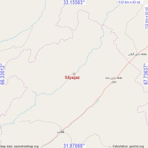
Sāyagaz GPS coordinates[2]
32° 33' 54.756" North, 67° 1' 59.664" East
| Map corner | latitude | longitude |
|---|---|---|
| Upper-left | 33.15583°, | 66.33012° |
| Center: | 32.56521°, | 67.03324° |
| Lower-right: | 31.97068°, | 67.73637° |
| Map W x H: | 131.8×131.8 km | = 81.9×81.9mi |
| max Lat: | 38.4435° ⇑87.8% North |
| Sāyagaz: | 32.56521° |
| min Lat: | ⇓12.2% South 30.15° |
| min Long | Sāyagaz | max Long |
| 61.06667° | 67.03324° | 72.318° |
| W 39.2%⇐ | ⇒60.8% E |
Elevation
Elevation of Sāyagaz is 1673 m = 5489 ft, and this is 254.6 m = 835 ft above average elevation for this country.
| Max E: |
3068 m = 10066 ft | 38.9% |
| Sāyagaz | 1673 m 5489 ft | |
| Avg. | 1418.4 m = 4654 ft | |
Min E: |
254 m = 833 ft | 61.1% |
See also: Afghanistan elevation on elevation.city.
Geographical zone
Sāyagaz is located in North temperate zone (between Tropic of Cancer and the Arctic Circle). Distance of this Northern Tropic circle is 1015 km =630.7 mi to South.| Distance of | km | miles | from Sāyagaz |
|---|---|---|---|
| North Pole | 6386.2 | 3968.2 | to North |
| Arctic Circle | 3780.3 | 2349 | to North |
| Tropic Cancer | 1015 | 630.7 | to South |
| Equator | 3620.9 | 2249.9 | to South |


Nearby cities:
15 places around Sāyagaz: (largest is in red/bold)
• Khākirān
30.6 km =19 mi,  7°
7°
• Muqêr
74.5 km =46.3 mi,  67°
67°
• Mīzān ‘Alāqahdārī
65.3 km =40.6 mi,  228°
228°
• Nāyak
24.3 km =15.1 mi,  271°
271°
• Qalāt
52.4 km =32.6 mi,  192°
192°
• Sang-e Māshah
74.3 km =46.2 mi,  30°
30°
• Sarfirāz Kalā
98.8 km =61.4 mi,  61°
61°
• Shahr-e Şafā
107.8 km =67 mi,  218°
218°
• Tarinkot
108.4 km =67.4 mi, 273°
• Uruzgān
55 km =34.2 mi,  317°
317°
• Zamtō Kêlay
83.1 km =51.6 mi,  255°
255°
• Ḩukūmat-e Shīnkaī
70.7 km =43.9 mi,  156°
156°
• ‘Alāqahdārī Aṯghar
97.2 km =60.4 mi, 161°
• ‘Alāqahdārī Gēlān
59.3 km =36.8 mi, 72°
• ‘Alāqahdārī Shāh Jōy
35.9 km =22.3 mi,  97°
97°
Sources, notices
• [Note1] Compared only with cities in Afghanistan existing in our database
• [Src1] Map data: © OpenStreetMap contributors (CC-BY-SA)
• [Src2] Other city data from geonames.org with taken over terms of usage.
• [Src3] Geographical zone / Annual Mean Temperature by Robert A. Rohde @ Wikipedia
