Ḩukūmat-e Shīnkaī geodata
Ḩukūmat-e Shīnkaī (Zabul) is a seat of a second-order administrative division; located in Afghanistan in Asia/Kabul (GMT+4.5) time zone. In our database, there are 93 cities with bigger population. Compared to other cities in Afghanistan, 93.2% of cities are located further ↑North; 59.5% of cities are located further →East and 71.4% of cities have lower elevation than Ḩukūmat-e Shīnkaī. Note1


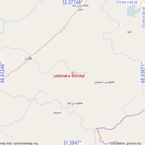
Ḩukūmat-e Shīnkaī GPS coordinates[2]
31° 58' 58.908" North, 67° 20' 8.088" East
| Map corner | latitude | longitude |
|---|---|---|
| Upper-left | 32.57748°, | 66.63246° |
| Center: | 31.98303°, | 67.33558° |
| Lower-right: | 31.3847°, | 68.03871° |
| Map W x H: | 132.6×132.6 km | = 82.4×82.4mi |
| max Lat: | 38.4435° ⇑93.2% North |
| Ḩukūmat-e Shīnkaī: | 31.98303° |
| min Lat: | ⇓6.8% South 30.15° |
| min Long | Ḩukūmat-e Sh | max Long |
| 61.06667° | 67.33558° | 72.318° |
| W 40.5%⇐ | ⇒59.5% E |
Elevation
Elevation of Ḩukūmat-e Shīnkaī is 1936 m = 6352 ft, and this is 517.6 m = 1698 ft above average elevation for this country.
| Max E: |
3068 m = 10066 ft | 28.6% |
| Ḩukūmat-e Shīnkaī | 1936 m 6352 ft | |
| Avg. | 1418.4 m = 4654 ft | |
Min E: |
254 m = 833 ft | 71.4% |
See also: Afghanistan elevation on elevation.city.
Geographical zone
Ḩukūmat-e Shīnkaī is located in North temperate zone (between Tropic of Cancer and the Arctic Circle). Distance of this Northern Tropic circle is 950.3 km =590.5 mi to South.| Distance of | km | miles | from Ḩukūmat-e Shīnkaī |
|---|---|---|---|
| North Pole | 6450.9 | 4008.4 | to North |
| Arctic Circle | 3845 | 2389.2 | to North |
| Tropic Cancer | 950.3 | 590.5 | to South |
| Equator | 3556.2 | 2209.7 | to South |


Nearby cities:
15 places around Ḩukūmat-e Shīnkaī: (largest is in red/bold)
• Arghestān
92.8 km =57.7 mi,  239°
239°
• Khākirān
98.2 km =61 mi,  345°
345°
• Khōshāmand
115.3 km =71.6 mi,  47°
47°
• Khūgyāṉī
85.2 km =52.9 mi, 236°
• Muqêr
101.6 km =63.1 mi,  23°
23°
• Mīzān ‘Alāqahdārī
80.4 km =50 mi,  285°
285°
• Nāyak
84.1 km =52.3 mi,  321°
321°
• Qalāt
42.5 km =26.4 mi, 288°
• Shahr-e Şafā
97.6 km =60.6 mi,  258°
258°
• Sāyagaz
70.7 km =43.9 mi,  336°
336°
• Uruzgān
124 km =77.1 mi,  327°
327°
• Zamtō Kêlay
117.3 km =72.9 mi, 291°
• ‘Alāqahdārī Aṯghar
27.6 km =17.1 mi,  175°
175°
• ‘Alāqahdārī Gēlān
87.4 km =54.3 mi, 18°
• ‘Alāqahdārī Shāh Jōy
60.3 km =37.5 mi,  6°
6°
Sources, notices
• [Note1] Compared only with cities in Afghanistan existing in our database
• [Src1] Map data: © OpenStreetMap contributors (CC-BY-SA)
• [Src2] Other city data from geonames.org with taken over terms of usage.
• [Src3] Geographical zone / Annual Mean Temperature by Robert A. Rohde @ Wikipedia
