Uruzgān geodata
Uruzgān (Oruzgan) is a populated place; located in Afghanistan in Asia/Kabul (GMT+4.5) time zone. With population of 13,388 people, there are 53 cities with bigger population in this country. Compared to other cities in Afghanistan, 83.3% of cities are located further ↑North; 65% of cities are located further →East and 74.6% of cities have lower elevation than Uruzgān. Note1


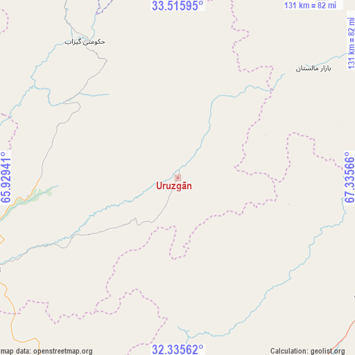
Uruzgān GPS coordinates[2]
32° 55' 39.9" North, 66° 37' 57.108" East
| Map corner | latitude | longitude |
|---|---|---|
| Upper-left | 33.51595°, | 65.92941° |
| Center: | 32.92775°, | 66.63253° |
| Lower-right: | 32.33562°, | 67.33566° |
| Map W x H: | 131.2×131.2 km | = 81.5×81.5mi |
| max Lat: | 38.4435° ⇑83.3% North |
| Uruzgān: | 32.92775° |
| min Lat: | ⇓16.7% South 30.15° |
| min Long | Uruzgān | max Long |
| 61.06667° | 66.63253° | 72.318° |
| W 35%⇐ | ⇒65% E |
Elevation
Elevation of Uruzgān is 2026 m = 6647 ft, and this is 607.6 m = 1993 ft above average elevation for this country.
| Max E: |
3068 m = 10066 ft | 25.4% |
| Uruzgān | 2026 m 6647 ft | |
| Avg. | 1418.4 m = 4654 ft | |
Min E: |
254 m = 833 ft | 74.6% |
See also: Afghanistan elevation on elevation.city.
Geographical zone
Uruzgān is located in North temperate zone (between Tropic of Cancer and the Arctic Circle). Distance of this Northern Tropic circle is 1055.3 km =655.7 mi to South.| Distance of | km | miles | from Uruzgān |
|---|---|---|---|
| North Pole | 6345.8 | 3943.1 | to North |
| Arctic Circle | 3740 | 2323.9 | to North |
| Tropic Cancer | 1055.3 | 655.7 | to South |
| Equator | 3661.2 | 2275 | to South |


Nearby cities:
15 places around Uruzgān: (largest is in red/bold)
• Chowṉêy
60.7 km =37.7 mi,  326°
326°
• Dê Nārkhēl Kêlay
108.4 km =67.4 mi,  239°
239°
• Khākirān
42.4 km =26.3 mi,  103°
103°
• Muqêr
106.8 km =66.4 mi, 96°
• Mīzān ‘Alāqahdārī
84.3 km =52.4 mi,  187°
187°
• Nāyak
41.7 km =25.9 mi,  161°
161°
• Nīlī
99.9 km =62.1 mi, 332°
• Qalāt
95 km =59 mi, 164°
• Sang-e Māshah
78.9 km =49 mi,  72°
72°
• Sar-e Tayghān
110 km =68.4 mi,  306°
306°
• Sāyagaz
55 km =34.2 mi,  137°
137°
• Tarinkot
77.9 km =48.4 mi, 244°
• Zamtō Kêlay
75 km =46.6 mi,  214°
214°
• ‘Alāqahdārī Gēlān
96.5 km =60 mi, 103°
• ‘Alāqahdārī Shāh Jōy
85.9 km =53.4 mi,  121°
121°
Sources, notices
• [Note1] Compared only with cities in Afghanistan existing in our database
• [Src1] Map data: © OpenStreetMap contributors (CC-BY-SA)
• [Src2] Other city data from geonames.org with taken over terms of usage.
• [Src3] Geographical zone / Annual Mean Temperature by Robert A. Rohde @ Wikipedia
