Wuluswālī ‘Alīngār geodata
Wuluswālī ‘Alīngār (Laghman) is a seat of a second-order administrative division; located in Afghanistan in Asia/Kabul (GMT+4.5) time zone. In our database, there are 93 cities with bigger population. Compared to other cities in Afghanistan, 55% of cities are located further ↓South; 86.5% of cities are located further ←West and 70.4% of cities have higher elevation than Wuluswālī ‘Alīngār. Note1


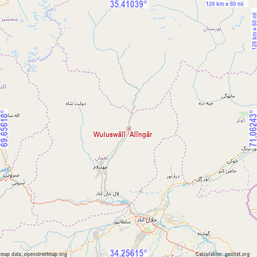
Wuluswālī ‘Alīngār GPS coordinates[2]
34° 50' 7.044" North, 70° 21' 33.48" East
| Map corner | latitude | longitude |
|---|---|---|
| Upper-left | 35.41039°, | 69.65618° |
| Center: | 34.83529°, | 70.3593° |
| Lower-right: | 34.25615°, | 71.06243° |
| Map W x H: | 128.3×128.3 km | = 79.7×79.7mi |
| max Lat: | 38.4435° ⇑45% North |
| Wuluswālī ‘Alīngār: | 34.83529° |
| min Lat: | ⇓55% South 30.15° |
| min Long | Wuluswālī ‘ | max Long |
| 61.06667° | 70.3593° | 72.318° |
| W 86.5%⇐ | ⇒13.5% E |
Elevation
Elevation of Wuluswālī ‘Alīngār is 937 m = 3074 ft, and this is 481.4 m = 1579 ft below average elevation for this country.
| Max E: |
3068 m = 10066 ft | 70.4% |
| Avg. | 1418.4 m = 4654 ft | |
| Wuluswālī ‘Alīngār | 937 m = 3074 ft | |
Min E: |
254 m = 833 ft | 29.6% |
See also: Afghanistan elevation on elevation.city.
Geographical zone
Wuluswālī ‘Alīngār is located in North temperate zone (between Tropic of Cancer and the Arctic Circle). Distance of this Northern Tropic circle is 1267.4 km =787.5 mi to South.| Distance of | km | miles | from Wuluswālī ‘Alīngār |
|---|---|---|---|
| North Pole | 6133.7 | 3811.3 | to North |
| Arctic Circle | 3527.9 | 2192.1 | to North |
| Tropic Cancer | 1267.4 | 787.5 | to South |
| Equator | 3873.3 | 2406.8 | to South |


Nearby cities:
15 places around Wuluswālī ‘Alīngār: (largest is in red/bold)
• Alah Sāy
58.7 km =36.5 mi,  276°
276°
• Dowlat Shāh
29.2 km =18.1 mi,  295°
295°
• Jalālābād
46.2 km =28.7 mi,  169°
169°
• Kanḏay
40.5 km =25.2 mi,  71°
71°
• Khafizan
61 km =37.9 mi,  178°
178°
• Mandōl
52.8 km =32.8 mi,  340°
340°
• Manogay
53.3 km =33.1 mi, 71°
• Mehtar Lām
22.8 km =14.2 mi,  216°
216°
• Nūrgal
44.5 km =27.7 mi,  123°
123°
• Qal‘ah-ye Shāhī
29.6 km =18.4 mi,  134°
134°
• Qarghah’ī
33 km =20.5 mi,  198°
198°
• Sangar Sarāy
54 km =33.6 mi,  151°
151°
• Sheywah
36 km =22.4 mi,  144°
144°
• Sulţānpūr-e ‘Ulyā
47.4 km =29.5 mi,  186°
186°
• Tsowkêy
54.2 km =33.7 mi,  107°
107°
Sources, notices
• [Note1] Compared only with cities in Afghanistan existing in our database
• [Src1] Map data: © OpenStreetMap contributors (CC-BY-SA)
• [Src2] Other city data from geonames.org with taken over terms of usage.
• [Src3] Geographical zone / Annual Mean Temperature by Robert A. Rohde @ Wikipedia
