Pārūn geodata
Pārūn (Nuristan) is a seat of a first-order administrative division; located in Afghanistan in Asia/Kabul (GMT+4.5) time zone. With population of 1,000 people, there are 91 cities with bigger population in this country. Compared to other cities in Afghanistan, 67.8% of cities are located further ↓South; 95.2% of cities are located further ←West and 98.4% of cities have lower elevation than Pārūn. Note1


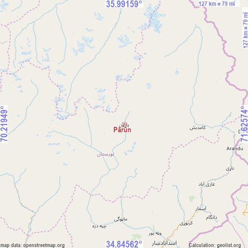
Pārūn GPS coordinates[2]
35° 25' 14.304" North, 70° 55' 21.396" East
| Map corner | latitude | longitude |
|---|---|---|
| Upper-left | 35.99159°, | 70.21949° |
| Center: | 35.42064°, | 70.92261° |
| Lower-right: | 34.84562°, | 71.62574° |
| Map W x H: | 127.4×127.4 km | = 79.2×79.2mi |
| max Lat: | 38.4435° ⇑32.2% North |
| Pārūn: | 35.42064° |
| min Lat: | ⇓67.8% South 30.15° |
| min Long | Pārūn | max Long |
| 61.06667° | 70.92261° | 72.318° |
| W 95.2%⇐ | ⇒4.8% E |
Elevation
Elevation of Pārūn is 2756 m = 9042 ft, and this is 1337.6 m = 4388 ft above average elevation for this country.
| Max E: |
3068 m = 10066 ft | 1.6% |
| Pārūn | 2756 m 9042 ft | |
| Avg. | 1418.4 m = 4654 ft | |
Min E: |
254 m = 833 ft | 98.4% |
See also: Afghanistan elevation on elevation.city.
Geographical zone
Pārūn is located in North temperate zone (between Tropic of Cancer and the Arctic Circle). Distance of this Northern Tropic circle is 1332.5 km =828 mi to South.| Distance of | km | miles | from Pārūn |
|---|---|---|---|
| North Pole | 6068.7 | 3770.9 | to North |
| Arctic Circle | 3462.8 | 2151.7 | to North |
| Tropic Cancer | 1332.5 | 828 | to South |
| Equator | 3938.4 | 2447.2 | to South |


Nearby cities:
15 places around Pārūn: (largest is in red/bold)
• Asadābād
64.2 km =39.9 mi,  161°
161°
• Barg-e Matāl
47.3 km =29.4 mi,  53°
53°
• Dāngām
65.6 km =40.8 mi,  136°
136°
• Kanḏay
53.5 km =33.2 mi,  194°
194°
• Karbori
59.8 km =37.2 mi,  147°
147°
• Kuran wa Munjan
68.9 km =42.8 mi,  348°
348°
• Mandōl
69.9 km =43.4 mi,  257°
257°
• Manogay
47.9 km =29.8 mi,  181°
181°
• Narang
74.3 km =46.2 mi,  171°
171°
• Nāṟay
58.8 km =36.5 mi,  112°
112°
• Sar Kāṉī
72.1 km =44.8 mi, 166°
• Tsowkêy
81 km =50.3 mi, 179°
• Wuluswālī ‘Alīngār
82.8 km =51.4 mi,  218°
218°
• Wuṯahpūr
58 km =36 mi, 163°
• Āsmār
58.5 km =36.4 mi, 137°
Sources, notices
• [Note1] Compared only with cities in Afghanistan existing in our database
• [Src1] Map data: © OpenStreetMap contributors (CC-BY-SA)
• [Src2] Other city data from geonames.org with taken over terms of usage.
• [Src3] Geographical zone / Annual Mean Temperature by Robert A. Rohde @ Wikipedia
