Maydanshakhr geodata
Maydanshakhr (Vardak) is a seat of a first-order administrative division; located in Afghanistan in Asia/Kabul (GMT+4.5) time zone. With population of 1,600 people, there are 89 cities with bigger population in this country. Compared to other cities in Afghanistan, 57.2% of cities are located further ↑North; 55.9% of cities are located further ←West and 83.9% of cities have lower elevation than Maydanshakhr. Note1


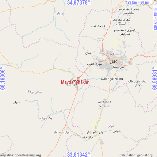
Maydanshakhr GPS coordinates[2]
34° 23' 44.196" North, 68° 51' 58.248" East
| Map corner | latitude | longitude |
|---|---|---|
| Upper-left | 34.97378°, | 68.16306° |
| Center: | 34.39561°, | 68.86618° |
| Lower-right: | 33.81342°, | 69.56931° |
| Map W x H: | 129×129 km | = 80.2×80.2mi |
| max Lat: | 38.4435° ⇑57.2% North |
| Maydanshakhr: | 34.39561° |
| min Lat: | ⇓42.8% South 30.15° |
| min Long | Maydanshakhr | max Long |
| 61.06667° | 68.86618° | 72.318° |
| W 55.9%⇐ | ⇒44.1% E |
Elevation
Elevation of Maydanshakhr is 2206 m = 7238 ft, and this is 787.6 m = 2584 ft above average elevation for this country.
| Max E: |
3068 m = 10066 ft | 16.1% |
| Maydanshakhr | 2206 m 7238 ft | |
| Avg. | 1418.4 m = 4654 ft | |
Min E: |
254 m = 833 ft | 83.9% |
See also: Afghanistan elevation on elevation.city.
Geographical zone
Maydanshakhr is located in North temperate zone (between Tropic of Cancer and the Arctic Circle). Distance of this Northern Tropic circle is 1218.5 km =757.1 mi to South.| Distance of | km | miles | from Maydanshakhr |
|---|---|---|---|
| North Pole | 6182.6 | 3841.7 | to North |
| Arctic Circle | 3576.7 | 2222.5 | to North |
| Tropic Cancer | 1218.5 | 757.1 | to South |
| Equator | 3824.4 | 2376.4 | to South |


Nearby cities:
15 places around Maydanshakhr: (largest is in red/bold)
• Bagrāmī
39 km =24.2 mi,  73°
73°
• Baraki Barak
48.2 km =30 mi,  170°
170°
• Chandal Bā’ī
22.6 km =14 mi,  21°
21°
• Deh-e Now
42.5 km =26.4 mi, 23°
• Jalrēz
21.1 km =13.1 mi,  293°
293°
• Kabul
31.7 km =19.7 mi,  62°
62°
• Markaz-e Sayyidābād
46.1 km =28.6 mi,  197°
197°
• Muḩammad Āghah Wuluswālī
29.5 km =18.3 mi,  133°
133°
• Mīr Bachah Kōṯ
45.7 km =28.4 mi,  30°
30°
• Paghmān
22.7 km =14.1 mi, 19°
• Pul-e Sangī
42.6 km =26.5 mi, 57°
• Pul-e ‘Alam
46.8 km =29.1 mi,  162°
162°
• Qal‘ah-ye Na‘īm
27.6 km =17.1 mi,  89°
89°
• Surkh Bilandī
35.4 km =22 mi, 24°
• Zargarān
47 km =29.2 mi, 22°
Sources, notices
• [Note1] Compared only with cities in Afghanistan existing in our database
• [Src1] Map data: © OpenStreetMap contributors (CC-BY-SA)
• [Src2] Other city data from geonames.org with taken over terms of usage.
• [Src3] Geographical zone / Annual Mean Temperature by Robert A. Rohde @ Wikipedia
