Yeghegis geodata
Yeghegis (Vayots Dzor) is a populated place; located in Armenia in Asia/Yerevan (GMT+4) time zone. With population of 1,045 people, there are 296 cities with bigger population in this country. Compared to other cities in Armenia, 88.5% of cities are located further ↑North; 88.2% of cities are located further ←West and 68.5% of cities have lower elevation than Yeghegis. Note1


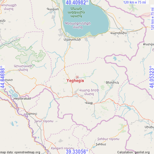
Yeghegis GPS coordinates[2]
39° 52' 20.316" North, 45° 21' 0.36" East
| Map corner | latitude | longitude |
|---|---|---|
| Upper-left | 40.40982°, | 44.64698° |
| Center: | 39.87231°, | 45.3501° |
| Lower-right: | 39.33056°, | 46.05323° |
| Map W x H: | 120×120 km | = 74.6×74.6mi |
| max Lat: | 41.24358° ⇑88.5% North |
| Yeghegis: | 39.87231° |
| min Lat: | ⇓11.5% South 38.90292° |
| min Long | Yeghegis | max Long |
| 43.74722° | 45.3501° | 46.5446° |
| W 88.2%⇐ | ⇒11.8% E |
Elevation
Elevation of Yeghegis is 1573 m = 5161 ft, and this is 271.5 m = 891 ft above average elevation for this country.
| Max E: |
2169 m = 7116 ft | 31.5% |
| Yeghegis | 1573 m 5161 ft | |
| Avg. | 1301.5 m = 4270 ft | |
Min E: |
440 m = 1444 ft | 68.5% |
See also: Armenia elevation on elevation.city.
Geographical zone
Yeghegis is located in North temperate zone (between Tropic of Cancer and the Arctic Circle). Distance of this Northern Tropic circle is 1827.5 km =1135.6 mi to South.| Distance of | km | miles | from Yeghegis |
|---|---|---|---|
| North Pole | 5573.7 | 3463.3 | to North |
| Arctic Circle | 2967.8 | 1844.1 | to North |
| Tropic Cancer | 1827.5 | 1135.6 | to South |
| Equator | 4433.4 | 2754.8 | to South |


Nearby cities:
15 places around Yeghegis: (largest is in red/bold)
• Agarakadzor
15.2 km =9.4 mi,  178°
178°
• Aghavnadzor
14.2 km =8.8 mi,  227°
227°
• Areni
22.4 km =13.9 mi,  219°
219°
• Getap’
12.6 km =7.8 mi,  196°
196°
• Gladzor
10.2 km =6.3 mi, 181°
• Jermuk
27.5 km =17.1 mi,  97°
97°
• Karanlukh
26.3 km =16.3 mi,  348°
348°
• Madina
24.1 km =15 mi,  340°
340°
• Malishka
14.7 km =9.1 mi,  161°
161°
• Rrind
19.2 km =11.9 mi, 229°
• Shatin
5.7 km =3.5 mi, 225°
• Vayk’
22.7 km =14.1 mi,  153°
153°
• Vernashen
9 km =5.6 mi,  172°
172°
• Yeghegnadzor
12.1 km =7.5 mi,  187°
187°
• Zangakatun
26.9 km =16.7 mi,  258°
258°
Sources, notices
• [Note1] Compared only with cities in Armenia existing in our database
• [Src1] Map data: © OpenStreetMap contributors (CC-BY-SA)
• [Src2] Other city data from geonames.org with taken over terms of usage.
• [Src3] Geographical zone / Annual Mean Temperature by Robert A. Rohde @ Wikipedia
