Aghavnadzor geodata
Aghavnadzor (Vayots Dzor) is a populated place; located in Armenia in Asia/Yerevan (GMT+4) time zone. With population of 1,925 people, there are 165 cities with bigger population in this country. Compared to other cities in Armenia, 91.7% of cities are located further ↑North; 83.4% of cities are located further ←West and 67.5% of cities have lower elevation than Aghavnadzor. Note1


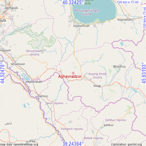
Aghavnadzor GPS coordinates[2]
39° 47' 9.852" North, 45° 13' 40.44" East
| Map corner | latitude | longitude |
|---|---|---|
| Upper-left | 40.32425°, | 44.52478° |
| Center: | 39.78607°, | 45.2279° |
| Lower-right: | 39.24364°, | 45.93103° |
| Map W x H: | 120.2×120.2 km | = 74.7×74.7mi |
| max Lat: | 41.24358° ⇑91.7% North |
| Aghavnadzor: | 39.78607° |
| min Lat: | ⇓8.3% South 38.90292° |
| min Long | Aghavnadzor | max Long |
| 43.74722° | 45.2279° | 46.5446° |
| W 83.4%⇐ | ⇒16.6% E |
Elevation
Elevation of Aghavnadzor is 1553 m = 5095 ft, and this is 251.5 m = 825 ft above average elevation for this country.
| Max E: |
2169 m = 7116 ft | 32.5% |
| Aghavnadzor | 1553 m 5095 ft | |
| Avg. | 1301.5 m = 4270 ft | |
Min E: |
440 m = 1444 ft | 67.5% |
See also: Armenia elevation on elevation.city.
Geographical zone
Aghavnadzor is located in North temperate zone (between Tropic of Cancer and the Arctic Circle). Distance of this Northern Tropic circle is 1817.9 km =1129.6 mi to South.| Distance of | km | miles | from Aghavnadzor |
|---|---|---|---|
| North Pole | 5583.3 | 3469.3 | to North |
| Arctic Circle | 2977.4 | 1850.1 | to North |
| Tropic Cancer | 1817.9 | 1129.6 | to South |
| Equator | 4423.8 | 2748.8 | to South |


Nearby cities:
15 places around Aghavnadzor: (largest is in red/bold)
• Agarakadzor
12.2 km =7.6 mi,  116°
116°
• Areni
8.6 km =5.3 mi,  206°
206°
• Armash
35.7 km =22.2 mi,  266°
266°
• Getap’
7.3 km =4.5 mi,  109°
109°
• Gladzor
10.2 km =6.3 mi,  93°
93°
• Madina
32.4 km =20.1 mi,  4°
4°
• Malishka
15.8 km =9.8 mi, 105°
• Rrind
5.1 km =3.2 mi,  236°
236°
• Shatin
8.5 km =5.3 mi,  49°
49°
• Vayk’
23.1 km =14.4 mi, 117°
• Vernashen
11.6 km =7.2 mi, 86°
• Yeghegis
14.2 km =8.8 mi, 47°
• Yeghegnadzor
9.3 km =5.8 mi, 105°
• Zangakatun
16.4 km =10.2 mi,  284°
284°
• Zarrit’ap’
29.2 km =18.1 mi, 124°
Sources, notices
• [Note1] Compared only with cities in Armenia existing in our database
• [Src1] Map data: © OpenStreetMap contributors (CC-BY-SA)
• [Src2] Other city data from geonames.org with taken over terms of usage.
• [Src3] Geographical zone / Annual Mean Temperature by Robert A. Rohde @ Wikipedia
