Areni geodata
Areni (Vayots Dzor) is a populated place; located in Armenia in Asia/Yerevan (GMT+4) time zone. With population of 1,718 people, there are 195 cities with bigger population in this country. Compared to other cities in Armenia, 94.3% of cities are located further ↑North; 81.5% of cities are located further ←West and 57% of cities have higher elevation than Areni. Note1


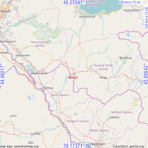
Areni GPS coordinates[2]
39° 43' 0.048" North, 45° 10' 59.844" East
| Map corner | latitude | longitude |
|---|---|---|
| Upper-left | 40.25541°, | 44.48017° |
| Center: | 39.71668°, | 45.18329° |
| Lower-right: | 39.17371°, | 45.88642° |
| Map W x H: | 120.3×120.3 km | = 74.8×74.8mi |
| max Lat: | 41.24358° ⇑94.3% North |
| Areni: | 39.71668° |
| min Lat: | ⇓5.7% South 38.90292° |
| min Long | Areni | max Long |
| 43.74722° | 45.18329° | 46.5446° |
| W 81.5%⇐ | ⇒18.5% E |
Elevation
Elevation of Areni is 1081 m = 3547 ft, and this is 220.5 m = 723 ft below average elevation for this country.
| Max E: |
2169 m = 7116 ft | 57% |
| Avg. | 1301.5 m = 4270 ft | |
| Areni | 1081 m = 3547 ft | |
Min E: |
440 m = 1444 ft | 43% |
See also: Armenia elevation on elevation.city.
Geographical zone
Areni is located in North temperate zone (between Tropic of Cancer and the Arctic Circle). Distance of this Northern Tropic circle is 1810.2 km =1124.8 mi to South.| Distance of | km | miles | from Areni |
|---|---|---|---|
| North Pole | 5591 | 3474.1 | to North |
| Arctic Circle | 2985.1 | 1854.9 | to North |
| Tropic Cancer | 1810.2 | 1124.8 | to South |
| Equator | 4416.1 | 2744 | to South |


Nearby cities:
15 places around Areni: (largest is in red/bold)
• Agarakadzor
14.9 km =9.3 mi,  81°
81°
• Aghavnadzor
8.6 km =5.3 mi,  26°
26°
• Armash
32.3 km =20.1 mi,  279°
279°
• Getap’
11.9 km =7.4 mi,  63°
63°
• Gladzor
15.7 km =9.8 mi, 63°
• Malishka
19.3 km =12 mi, 79°
• Rrind
5 km =3.1 mi,  354°
354°
• Shatin
16.8 km =10.4 mi,  37°
37°
• Surenavan
36 km =22.4 mi, 283°
• Vayk’
24.4 km =15.2 mi,  97°
97°
• Vernashen
17.6 km =10.9 mi, 61°
• Yeghegis
22.4 km =13.9 mi, 39°
• Yeghegnadzor
13.8 km =8.6 mi,  67°
67°
• Zangakatun
16.9 km =10.5 mi,  314°
314°
• Zarrit’ap’
29.4 km =18.3 mi,  107°
107°
Sources, notices
• [Note1] Compared only with cities in Armenia existing in our database
• [Src1] Map data: © OpenStreetMap contributors (CC-BY-SA)
• [Src2] Other city data from geonames.org with taken over terms of usage.
• [Src3] Geographical zone / Annual Mean Temperature by Robert A. Rohde @ Wikipedia
