Zangakatun geodata
Zangakatun (Ararat) is a populated place; located in Armenia in Asia/Yerevan (GMT+4) time zone. With population of 1,130 people, there are 281 cities with bigger population in this country. Compared to other cities in Armenia, 90.8% of cities are located further ↑North; 77.1% of cities are located further ←West and 74.8% of cities have lower elevation than Zangakatun. Note1


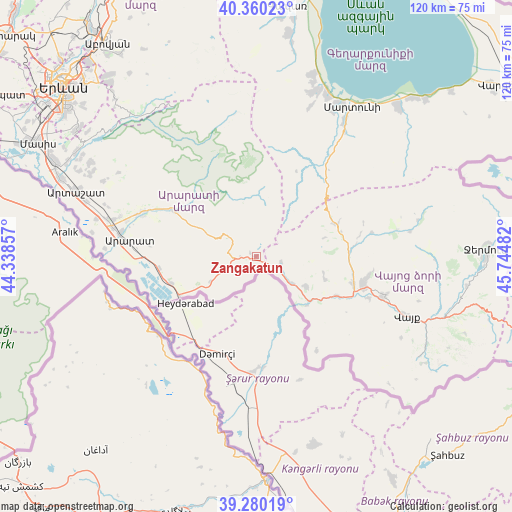
Zangakatun GPS coordinates[2]
39° 49' 20.388" North, 45° 2' 30.084" East
| Map corner | latitude | longitude |
|---|---|---|
| Upper-left | 40.36023°, | 44.33857° |
| Center: | 39.82233°, | 45.04169° |
| Lower-right: | 39.28019°, | 45.74482° |
| Map W x H: | 120.1×120.1 km | = 74.6×74.6mi |
| max Lat: | 41.24358° ⇑90.8% North |
| Zangakatun: | 39.82233° |
| min Lat: | ⇓9.2% South 38.90292° |
| min Long | Zangakatun | max Long |
| 43.74722° | 45.04169° | 46.5446° |
| W 77.1%⇐ | ⇒22.9% E |
Elevation
Elevation of Zangakatun is 1679 m = 5509 ft, and this is 377.5 m = 1239 ft above average elevation for this country.
| Max E: |
2169 m = 7116 ft | 25.2% |
| Zangakatun | 1679 m 5509 ft | |
| Avg. | 1301.5 m = 4270 ft | |
Min E: |
440 m = 1444 ft | 74.8% |
See also: Armenia elevation on elevation.city.
Geographical zone
Zangakatun is located in North temperate zone (between Tropic of Cancer and the Arctic Circle). Distance of this Northern Tropic circle is 1821.9 km =1132.1 mi to South.| Distance of | km | miles | from Zangakatun |
|---|---|---|---|
| North Pole | 5579.2 | 3466.8 | to North |
| Arctic Circle | 2973.3 | 1847.5 | to North |
| Tropic Cancer | 1821.9 | 1132.1 | to South |
| Equator | 4427.8 | 2751.3 | to South |


Nearby cities:
15 places around Zangakatun: (largest is in red/bold)
• Agarakadzor
28.5 km =17.7 mi,  109°
109°
• Aghavnadzor
16.4 km =10.2 mi,  104°
104°
• Ararat
28.7 km =17.8 mi,  271°
271°
• Areni
16.9 km =10.5 mi,  134°
134°
• Armash
20.6 km =12.8 mi,  252°
252°
• Getap’
23.7 km =14.7 mi, 105°
• Gladzor
26.5 km =16.5 mi, 100°
• Goravan
28 km =17.4 mi,  289°
289°
• Rrind
13.5 km =8.4 mi,  120°
120°
• Shatin
22.4 km =13.9 mi,  86°
86°
• Surenavan
23 km =14.3 mi,  262°
262°
• Vedi
28.9 km =18 mi, 290°
• Vernashen
27.7 km =17.2 mi, 96°
• Yeghegis
26.9 km =16.7 mi,  78°
78°
• Yeghegnadzor
25.7 km =16 mi, 104°
Sources, notices
• [Note1] Compared only with cities in Armenia existing in our database
• [Src1] Map data: © OpenStreetMap contributors (CC-BY-SA)
• [Src2] Other city data from geonames.org with taken over terms of usage.
• [Src3] Geographical zone / Annual Mean Temperature by Robert A. Rohde @ Wikipedia
