Berdavan geodata
Berdavan (Tavush) is a populated place; located in Armenia in Asia/Yerevan (GMT+4) time zone. With population of 3,000 people, there are 93 cities with bigger population in this country. Compared to other cities in Armenia, 99.7% of cities are located further ↓South; 76.4% of cities are located further ←West and 97.8% of cities have higher elevation than Berdavan. Note1


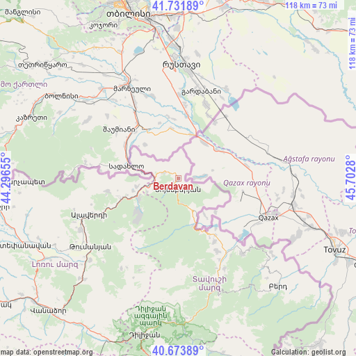
Berdavan GPS coordinates[2]
41° 12' 18.108" North, 44° 59' 58.812" East
| Map corner | latitude | longitude |
|---|---|---|
| Upper-left | 41.73189°, | 44.29655° |
| Center: | 41.20503°, | 44.99967° |
| Lower-right: | 40.67389°, | 45.7028° |
| Map W x H: | 117.6×117.6 km | = 73.1×73.1mi |
| max Lat: | 41.24358° ⇑0.3% North |
| Berdavan: | 41.20503° |
| min Lat: | ⇓99.7% South 38.90292° |
| min Long | Berdavan | max Long |
| 43.74722° | 44.99967° | 46.5446° |
| W 76.4%⇐ | ⇒23.6% E |
Elevation
Elevation of Berdavan is 705 m = 2313 ft, and this is 596.5 m = 1957 ft below average elevation for this country.
| Max E: |
2169 m = 7116 ft | 97.8% |
| Avg. | 1301.5 m = 4270 ft | |
| Berdavan | 705 m = 2313 ft | |
Min E: |
440 m = 1444 ft | 2.2% |
See also: Armenia elevation on elevation.city.
Geographical zone
Berdavan is located in North temperate zone (between Tropic of Cancer and the Arctic Circle). Distance of this Northern Tropic circle is 1975.7 km =1227.6 mi to South.| Distance of | km | miles | from Berdavan |
|---|---|---|---|
| North Pole | 5425.5 | 3371.2 | to North |
| Arctic Circle | 2819.6 | 1752 | to North |
| Tropic Cancer | 1975.7 | 1227.6 | to South |
| Equator | 4581.6 | 2846.9 | to South |


Nearby cities:
15 places around Berdavan: (largest is in red/bold)
• Akht’ala
20.6 km =12.8 mi,  258°
258°
• Alaverdi
29.8 km =18.5 mi,  246°
246°
• Archis
11.3 km =7 mi, 245°
• Aygehovit
32.7 km =20.3 mi,  140°
140°
• Azatamut
29.3 km =18.2 mi,  147°
147°
• Bagratashen
15.8 km =9.8 mi,  285°
285°
• Chochkan
14.3 km =8.9 mi, 259°
• Ijevan
38.4 km =23.9 mi,  161°
161°
• Khasht’arrak
33.5 km =20.8 mi, 152°
• Lorut
35.4 km =22 mi,  212°
212°
• Noyemberyan
3.6 km =2.2 mi,  180°
180°
• Odzun
36.5 km =22.7 mi,  242°
242°
• Sarigyugh
22.5 km =14 mi, 147°
• Shnogh
14.8 km =9.2 mi, 244°
• Voskevan
10.8 km =6.7 mi, 150°
Sources, notices
• [Note1] Compared only with cities in Armenia existing in our database
• [Src1] Map data: © OpenStreetMap contributors (CC-BY-SA)
• [Src2] Other city data from geonames.org with taken over terms of usage.
• [Src3] Geographical zone / Annual Mean Temperature by Robert A. Rohde @ Wikipedia
