Bagratashen geodata
Bagratashen (Tavush) is a populated place; located in Armenia in Asia/Yerevan (GMT+4) time zone. With population of 3,024 people, there are 92 cities with bigger population in this country. Compared to other cities in Armenia, 100% of cities are located further ↓South; 72% of cities are located further ←West and 100% of cities have higher elevation than Bagratashen. Note1


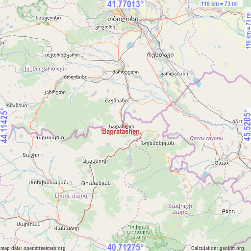
Bagratashen GPS coordinates[2]
41° 14' 36.888" North, 44° 49' 2.532" East
| Map corner | latitude | longitude |
|---|---|---|
| Upper-left | 41.77013°, | 44.11425° |
| Center: | 41.24358°, | 44.81737° |
| Lower-right: | 40.71275°, | 45.5205° |
| Map W x H: | 117.6×117.6 km | = 73.1×73.1mi |
| max Lat: | 41.24358° ⇑0% North |
| Bagratashen: | 41.24358° |
| min Lat: | ⇓100% South 38.90292° |
| min Long | Bagratashen | max Long |
| 43.74722° | 44.81737° | 46.5446° |
| W 72%⇐ | ⇒28% E |
Elevation
Elevation of Bagratashen is 440 m = 1444 ft, and this is 861.5 m = 2826 ft below average elevation for this country.
| Max E: |
2169 m = 7116 ft | 100% |
| Avg. | 1301.5 m = 4270 ft | |
| Bagratashen | 440 m = 1444 ft | |
Min E: |
440 m = 1444 ft | 0% |
See also: Armenia elevation on elevation.city.
Geographical zone
Bagratashen is located in North temperate zone (between Tropic of Cancer and the Arctic Circle). Distance of this Northern Tropic circle is 1979.9 km =1230.3 mi to South.| Distance of | km | miles | from Bagratashen |
|---|---|---|---|
| North Pole | 5421.2 | 3368.6 | to North |
| Arctic Circle | 2815.3 | 1749.3 | to North |
| Tropic Cancer | 1979.9 | 1230.3 | to South |
| Equator | 4585.9 | 2849.5 | to South |


Nearby cities:
15 places around Bagratashen: (largest is in red/bold)
• Agarak
39 km =24.2 mi,  228°
228°
• Akht’ala
9.7 km =6 mi,  210°
210°
• Alaverdi
20.2 km =12.6 mi,  216°
216°
• Archis
10.2 km =6.3 mi,  151°
151°
• Berdavan
15.8 km =9.8 mi,  105°
105°
• Chochkan
7 km =4.3 mi,  169°
169°
• Dsegh
34.3 km =21.3 mi,  204°
204°
• Lorut
34.3 km =21.3 mi,  186°
186°
• Noyemberyan
17.1 km =10.6 mi,  117°
117°
• Odzun
27.2 km =16.9 mi, 218°
• Sarigyugh
35.9 km =22.3 mi,  130°
130°
• Shnogh
10.9 km =6.8 mi, 169°
• Urrut
40.3 km =25 mi,  240°
240°
• Vardablur
39.8 km =24.7 mi, 220°
• Voskevan
24.7 km =15.3 mi, 123°
Sources, notices
• [Note1] Compared only with cities in Armenia existing in our database
• [Src1] Map data: © OpenStreetMap contributors (CC-BY-SA)
• [Src2] Other city data from geonames.org with taken over terms of usage.
• [Src3] Geographical zone / Annual Mean Temperature by Robert A. Rohde @ Wikipedia
