Lorut geodata
Lorut (Lori) is a populated place; located in Armenia in Asia/Yerevan (GMT+4) time zone. With population of 1,101 people, there are 287 cities with bigger population in this country. Compared to other cities in Armenia, 92.4% of cities are located further ↓South; 70.1% of cities are located further ←West and 63.4% of cities have lower elevation than Lorut. Note1


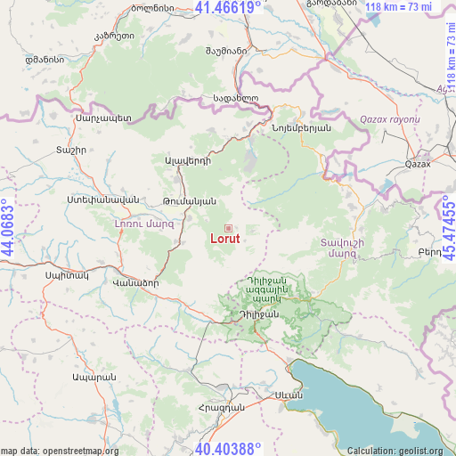
Lorut GPS coordinates[2]
40° 56' 13.812" North, 44° 46' 17.112" East
| Map corner | latitude | longitude |
|---|---|---|
| Upper-left | 41.46619°, | 44.0683° |
| Center: | 40.93717°, | 44.77142° |
| Lower-right: | 40.40388°, | 45.47455° |
| Map W x H: | 118.1×118.1 km | = 73.4×73.4mi |
| max Lat: | 41.24358° ⇑7.6% North |
| Lorut: | 40.93717° |
| min Lat: | ⇓92.4% South 38.90292° |
| min Long | Lorut | max Long |
| 43.74722° | 44.77142° | 46.5446° |
| W 70.1%⇐ | ⇒29.9% E |
Elevation
Elevation of Lorut is 1499 m = 4918 ft, and this is 197.5 m = 648 ft above average elevation for this country.
| Max E: |
2169 m = 7116 ft | 36.6% |
| Lorut | 1499 m 4918 ft | |
| Avg. | 1301.5 m = 4270 ft | |
Min E: |
440 m = 1444 ft | 63.4% |
See also: Armenia elevation on elevation.city.
Geographical zone
Lorut is located in North temperate zone (between Tropic of Cancer and the Arctic Circle). Distance of this Northern Tropic circle is 1945.9 km =1209.1 mi to South.| Distance of | km | miles | from Lorut |
|---|---|---|---|
| North Pole | 5455.3 | 3389.8 | to North |
| Arctic Circle | 2849.4 | 1770.5 | to North |
| Tropic Cancer | 1945.9 | 1209.1 | to South |
| Equator | 4551.8 | 2828.4 | to South |


Nearby cities:
15 places around Lorut: (largest is in red/bold)
• Akht’ala
25.7 km =16 mi,  357°
357°
• Alaverdi
19.7 km =12.2 mi,  335°
335°
• Dilijan
22.7 km =14.1 mi,  163°
163°
• Dsegh
10.6 km =6.6 mi,  284°
284°
• Fioletovo
24.3 km =15.1 mi,  190°
190°
• Gugark’
24.4 km =15.2 mi,  232°
232°
• Gyulagarak
25.4 km =15.8 mi, 277°
• Haghartsin
24.4 km =15.2 mi,  137°
137°
• Margahovit
23.8 km =14.8 mi,  197°
197°
• Odzun
18.5 km =11.5 mi,  314°
314°
• Shahumyan
26.2 km =16.3 mi, 226°
• Shnogh
24 km =14.9 mi,  13°
13°
• Vahagni
14.1 km =8.8 mi,  256°
256°
• Vardablur
22.4 km =13.9 mi, 279°
• Yeghegnut
12.3 km =7.6 mi,  252°
252°
Sources, notices
• [Note1] Compared only with cities in Armenia existing in our database
• [Src1] Map data: © OpenStreetMap contributors (CC-BY-SA)
• [Src2] Other city data from geonames.org with taken over terms of usage.
• [Src3] Geographical zone / Annual Mean Temperature by Robert A. Rohde @ Wikipedia
