Alaverdi geodata
Alaverdi (Lori) is a populated place; located in Armenia in Asia/Yerevan (GMT+4) time zone. With population of 13,184 people, there are 20 cities with bigger population in this country. Compared to other cities in Armenia, 96.5% of cities are located further ↓South; 65% of cities are located further ←West and 98.1% of cities have higher elevation than Alaverdi. Note1


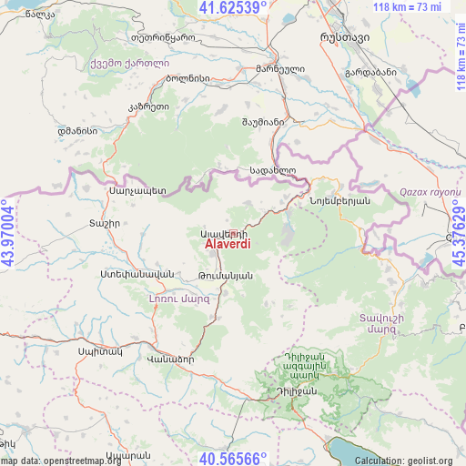
Alaverdi GPS coordinates[2]
41° 5' 51.576" North, 44° 40' 23.376" East
| Map corner | latitude | longitude |
|---|---|---|
| Upper-left | 41.62539°, | 43.97004° |
| Center: | 41.09766°, | 44.67316° |
| Lower-right: | 40.56566°, | 45.37629° |
| Map W x H: | 117.8×117.8 km | = 73.2×73.2mi |
| max Lat: | 41.24358° ⇑3.5% North |
| Alaverdi: | 41.09766° |
| min Lat: | ⇓96.5% South 38.90292° |
| min Long | Alaverdi | max Long |
| 43.74722° | 44.67316° | 46.5446° |
| W 65%⇐ | ⇒35% E |
Elevation
Elevation of Alaverdi is 699 m = 2293 ft, and this is 602.5 m = 1977 ft below average elevation for this country.
| Max E: |
2169 m = 7116 ft | 98.1% |
| Avg. | 1301.5 m = 4270 ft | |
| Alaverdi | 699 m = 2293 ft | |
Min E: |
440 m = 1444 ft | 1.9% |
See also: Armenia elevation on elevation.city.
Geographical zone
Alaverdi is located in North temperate zone (between Tropic of Cancer and the Arctic Circle). Distance of this Northern Tropic circle is 1963.7 km =1220.2 mi to South.| Distance of | km | miles | from Alaverdi |
|---|---|---|---|
| North Pole | 5437.4 | 3378.6 | to North |
| Arctic Circle | 2831.5 | 1759.4 | to North |
| Tropic Cancer | 1963.7 | 1220.2 | to South |
| Equator | 4569.6 | 2839.4 | to South |


Nearby cities:
15 places around Alaverdi: (largest is in red/bold)
• Agarak
19.7 km =12.2 mi,  240°
240°
• Akht’ala
10.6 km =6.6 mi,  42°
42°
• Archis
18.5 km =11.5 mi,  66°
66°
• Bagratashen
20.2 km =12.6 mi, 36°
• Chochkan
16.2 km =10.1 mi,  55°
55°
• Dsegh
15.2 km =9.4 mi,  187°
187°
• Gyulagarak
22.3 km =13.9 mi,  229°
229°
• Lorut
19.7 km =12.2 mi,  155°
155°
• Odzun
7 km =4.3 mi, 225°
• Shnogh
15 km =9.3 mi, 68°
• Step’anavan
26 km =16.2 mi,  247°
247°
• Urrut
23.4 km =14.5 mi,  261°
261°
• Vahagni
21.9 km =13.6 mi, 194°
• Vardablur
19.7 km =12.2 mi,  224°
224°
• Yeghegnut
21.9 km =13.6 mi, 189°
Sources, notices
• [Note1] Compared only with cities in Armenia existing in our database
• [Src1] Map data: © OpenStreetMap contributors (CC-BY-SA)
• [Src2] Other city data from geonames.org with taken over terms of usage.
• [Src3] Geographical zone / Annual Mean Temperature by Robert A. Rohde @ Wikipedia
