Tsovazard geodata
Tsovazard (Gegharkunik) is a populated place; located in Armenia in Asia/Yerevan (GMT+4) time zone. With population of 1,949 people, there are 161 cities with bigger population in this country. Compared to other cities in Armenia, 67.2% of cities are located further ↓South; 77.4% of cities are located further ←West and 91.4% of cities have lower elevation than Tsovazard. Note1


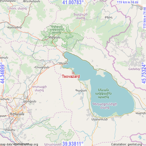
Tsovazard GPS coordinates[2]
40° 28' 30.36" North, 45° 3' 0.396" East
| Map corner | latitude | longitude |
|---|---|---|
| Upper-left | 41.00783°, | 44.34699° |
| Center: | 40.4751°, | 45.05011° |
| Lower-right: | 39.93811°, | 45.75324° |
| Map W x H: | 118.9×118.9 km | = 73.9×73.9mi |
| max Lat: | 41.24358° ⇑32.8% North |
| Tsovazard: | 40.4751° |
| min Lat: | ⇓67.2% South 38.90292° |
| min Long | Tsovazard | max Long |
| 43.74722° | 45.05011° | 46.5446° |
| W 77.4%⇐ | ⇒22.6% E |
Elevation
Elevation of Tsovazard is 1944 m = 6378 ft, and this is 642.5 m = 2108 ft above average elevation for this country.
| Max E: |
2169 m = 7116 ft | 8.6% |
| Tsovazard | 1944 m 6378 ft | |
| Avg. | 1301.5 m = 4270 ft | |
Min E: |
440 m = 1444 ft | 91.4% |
See also: Armenia elevation on elevation.city.
Geographical zone
Tsovazard is located in North temperate zone (between Tropic of Cancer and the Arctic Circle). Distance of this Northern Tropic circle is 1894.5 km =1177.2 mi to South.| Distance of | km | miles | from Tsovazard |
|---|---|---|---|
| North Pole | 5506.7 | 3421.7 | to North |
| Arctic Circle | 2900.8 | 1802.5 | to North |
| Tropic Cancer | 1894.5 | 1177.2 | to South |
| Equator | 4500.4 | 2796.4 | to South |


Nearby cities:
15 places around Tsovazard: (largest is in red/bold)
• Ddmashen
21.9 km =13.6 mi,  298°
298°
• Drakhtik
18.7 km =11.6 mi,  57°
57°
• Gagarin
16.9 km =10.5 mi, 295°
• Gandzak
18.6 km =11.6 mi,  163°
163°
• Gavarr
14.8 km =9.2 mi, 155°
• Geghamavan
16.7 km =10.4 mi,  305°
305°
• Hrazdan
24.1 km =15 mi,  275°
275°
• Lchap’
3 km =1.9 mi,  135°
135°
• Lchashen
11.3 km =7 mi, 296°
• Lerrnanist
21.8 km =13.5 mi,  267°
267°
• Noratus
15.4 km =9.6 mi,  134°
134°
• Sarukhan
21.5 km =13.4 mi, 161°
• Sevan
12.2 km =7.6 mi, 311°
• Tsovagyugh
19.1 km =11.9 mi,  336°
336°
• Varser
15 km =9.3 mi, 306°
Sources, notices
• [Note1] Compared only with cities in Armenia existing in our database
• [Src1] Map data: © OpenStreetMap contributors (CC-BY-SA)
• [Src2] Other city data from geonames.org with taken over terms of usage.
• [Src3] Geographical zone / Annual Mean Temperature by Robert A. Rohde @ Wikipedia
